MetView

MetView 2.0 is an easy-to-use system for accessing and displaying meteorological data. MetView is currently used at the Hanford Emergency Operations Center (EOC), the Hanford Meteorology Station, and in numerous research offices at Hanford. It is also used in support of emergency operations at the Energy Northwest Columbia Generating Station nuclear power plant. An Idaho version of MetView is used by State of Idaho in support of their emergency operations program for the area surrounding the Idaho National Environmental and Engineering Laboratory.
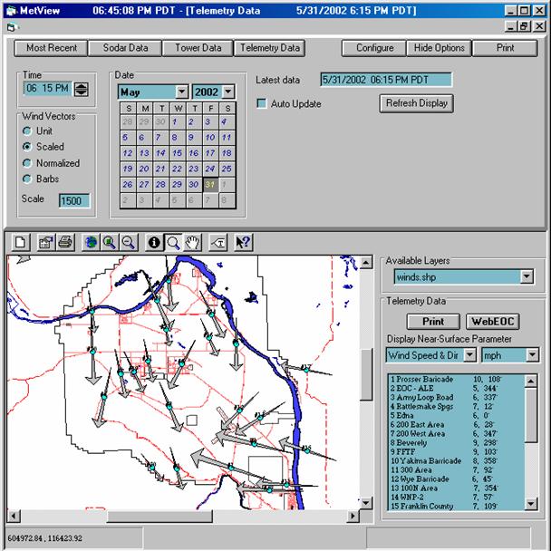
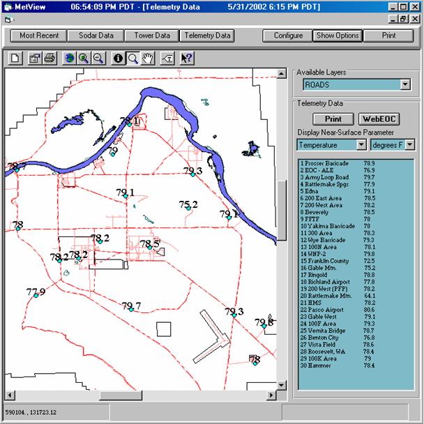
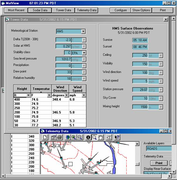
MetView provides graphical and numerical presentations of meteorological parameters. This includes real time and historical data from near surface monitoring locations, instrumented towers, remote monitoring equipment, and meteorologist observations. MetView graphically displays data from 30 monitoring stations on the Hanford Site - including measurements of near-surface winds, temperatures, precipitation, and atmospheric pressure.

MetView aids in the access, visualization, and interpretation of the real-time meteorological data. It is operated by meteorologists, hazard evaluators, administrative support personnel, and first-responders (i.e., the first staff members to arrive at the EOC during an emergency event). Output products are routinely used by Site decision-makers, state and county representatives, field team managers, and other EOC staff members. MetView displays are used in the formulation of protective action recommendations and to enhance the activities of emergency response personnel in the field. To be an effective tool for such a diverse audience, MetView must operate quickly, be very simple to use, and have easily interpreted output products.

At the Hanford Meteorology Station, MetView provides meteorologists and support staff with timely, straighforward, and impactful presentations of meteorological data. The system is used to display and assess current meteorological conditions across the Site, recent data to support the meteorologists in forecasting trends in meteorological conditions and historical data to assist in recognizing characteristic circulation patterns and the way they evolve under different circumstances.

At other Site locations, MetView is used for a variety of operational and research applications. MetView is used to assess meteorological conditions for dispersion modeling, develop scenario packages for emergency response training exercises, and evaluate meteorological conditions for on-site field experiments.
When MetView is first run, the program screen will automatically display the most recent meteorological data collected from the meteorological monitoring network. MetView can be set to automatically display new data when they become available or to continue to display data specified by the user.