Telemetry Data Display

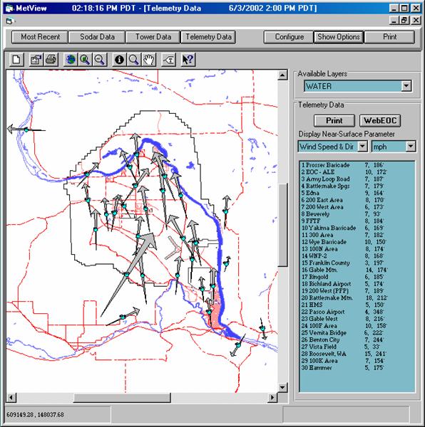
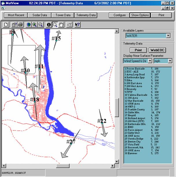
The Telemetry Data display shows how winds, temperature, precipitation, and atmospheric pressure vary across the Hanford Site. Wind vectors are plotted at their monitoring location and show the direction and relative speed of the wind. The user can zoom in for a more detailed look at an area on the site or zoom out for a regional perspective.

Numerical information is provided on the right side of the display. The station identification number, name, wind speed, and direction are provided. If the display window is too small to allow all of the station's data to appear, a scroll bar is provided to allow the user to move any station's data into the window.

The user can to generate a hardcopy of any Telemetry data plot or transfer an electronic copy to the Web to make the display available at other workstations.
Displaying Wind Data
Wind direction and speed can be displayed graphically as transport vectors or wind barbs. Transport vectors are arrows that show the direction the wind is blowing. These vectors can be drawn as 'unit' vectors with a constant size or as 'scaled' or 'normalized' vectors with the length of the transport arrow being proportionate to the wind speed. In the normalized mode, the ratio between the length of the transport vector and wind speed is computed by the model and is based on the highest wind speed at any monitoring station.
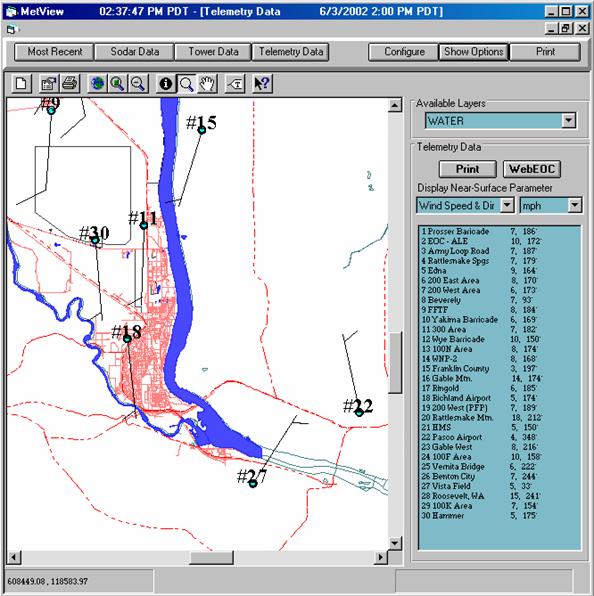
Wind barbs are a more traditional method (historically employed by meteorologists) that are used by meteorologists at the HMS to analyze Site winds. The wind barb indicates the direction the wind is blowing from and the number of barbs on its tail indicates the wind speed. For both scaled vectors and wind barbs, the user can adjust the scaling factor that determines the mean size of the wind display.

All the wind observations presented in this product are made at approximately 9 m (30 ft) above ground level. The graphical product presents a background map of the Hanford Site and the surrounding area. The Site boundary, major operating areas, roads, rivers (and other water bodies) are displayed on the background map. The location of each monitoring station (small circles) are displayed alongside the station's two-digit identification number. Numerical information is provided on the right side of the display. The station identification number, name, wind speed (mph), and direction (degrees from North) are provided.
Displaying Temperature, Precipitation, Atmospheric Pressure and Elevation
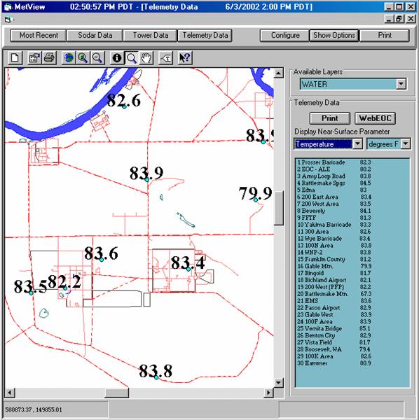
The Telemetry Data display has many parameters other than wind. These include measurements from temperature, precipitation, atmospheric pressure and elevation. Graphical and numerical data from each of the near-surface monitoring stations is displayed. Temperature and atmospheric pressure measurements are made at approximately 1.7 m (5.5 ft) above ground level. Precipitation and station elevation are measured at ground level. While winds and temperatures are measured at every station, atmospheric pressure and precipitation are only measured at selected stations. Missing data is indicated by a missing data code (such as -99 or -99.99).
