Subsurface
Science
Investigating below
ground to protect and
remediate water and soil
Researchers sieve soils from a Great Lakes Bioenergy Research Center site in Michigan. The soils were being prepped for incubation to investigate long-term carbon storage.
Andrea Starr | Pacific Northwest National Laboratory
Pacific Northwest National Laboratory (PNNL) takes research underground, aiming for in-depth understanding and real-time control of natural and engineered systems in the subsurface.
Our subsurface science informs environmental management through expertise in the geosciences, decision sciences, and high-performance computing. Such science improves contaminant remediation and isolation measures, legacy waste storage and disposal, and how energy sources are accessed and extracted.
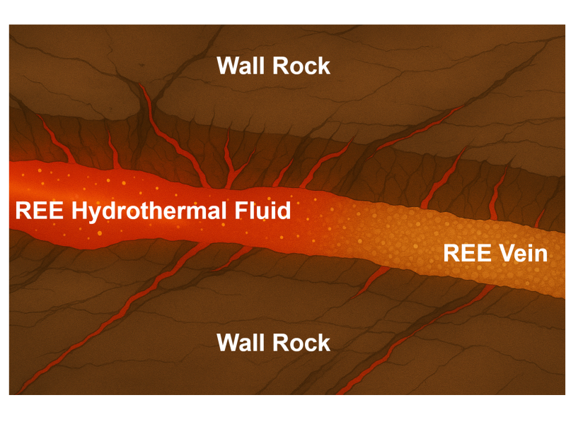
A systems-based approach enables decisions about complex sites where restoration may be uncertain, where time frames are long, or where adaptive management approaches are needed. With a “science-to-solutions” philosophy, PNNL’s subsurface scientists determine the nature and extent of contamination, create remedial designs, undertake remedial action and stabilization, and simulate and monitor end states. They also search for ways to advance the extraction of subsurface critical minerals, carbon mineralization, geothermal energy, and sustainable oil and gas recovery.
PNNL has fully equipped, radiologically controlled wet chemistry and analytical laboratories that allow researchers to safely analyze radioactively contaminated water and sediment samples. Environmental microbiology researchers use genetics, biochemistry, physiology, and microbial ecology to determine how microbes influence biogeochemical processes, energy production, and the fate and transport of contaminants.
We also maintain laboratories to measure the physical and hydraulic properties of soils and vadose zone sediments. The vadose zone—a layer of unsaturated sediments between the soil surface and the water table—controls the quantity and quality of groundwater.
PNNL scientists and engineers develop geophysical tools and inversion models for subsurface imaging and monitoring. Subsurface science capabilities, informed by high-performance computing, include multi-channel field electrical resistivity tomography, borehole ground-penetrating radar, surface seismic and borehole air gun seismic systems, electromagnetic induction, and a distributed temperature sensing system.
E4D-RT, the R&D 100 Award-winning real-time four-dimensional subsurface imaging software developed by PNNL, enables users to remotely look into the subsurface with 3D, time-lapse images to “see” the impact of contaminants in soils, which often provide a high-contrast medium compared to clean soils. This tool is also used to understand the detailed structure of the subsurface for advanced geothermal and resource recovery systems, and to investigate the confining structure around CO₂ storage reservoirs.
Since the 1960s, we have developed and applied predictive models for groundwater flow and contaminant transport in hydrologic systems. This longtime experience allows PNNL to help sponsors and partners predict groundwater flow velocity and direction, contaminant concentrations, and transport rates—data that inform estimates of public and environmental risk.
PNNL also has extensive experience in characterizing and assessing the deep vadose zone, whose physical and hydraulic characteristics slow the flow of water and contaminants to and from the water table. PNNL designs and conducts field-scale infiltration and transport tests. The lab remotely monitors vadose zone variables—including water content, matric potential, and temperature—and designs and tests advanced data-collection sensors.