Quick Facts
- Location: Southeastern Wisconsin (four-county region)
- Primary Function: Multi-use recreation and transportation
- Key Outcome: Successful integration of public recreation opportunities and transportation with ongoing utility operations. The trail network connects city neighborhoods, suburbs, and rural landscapes, making it easier for people to walk, bike, and access greenspace.
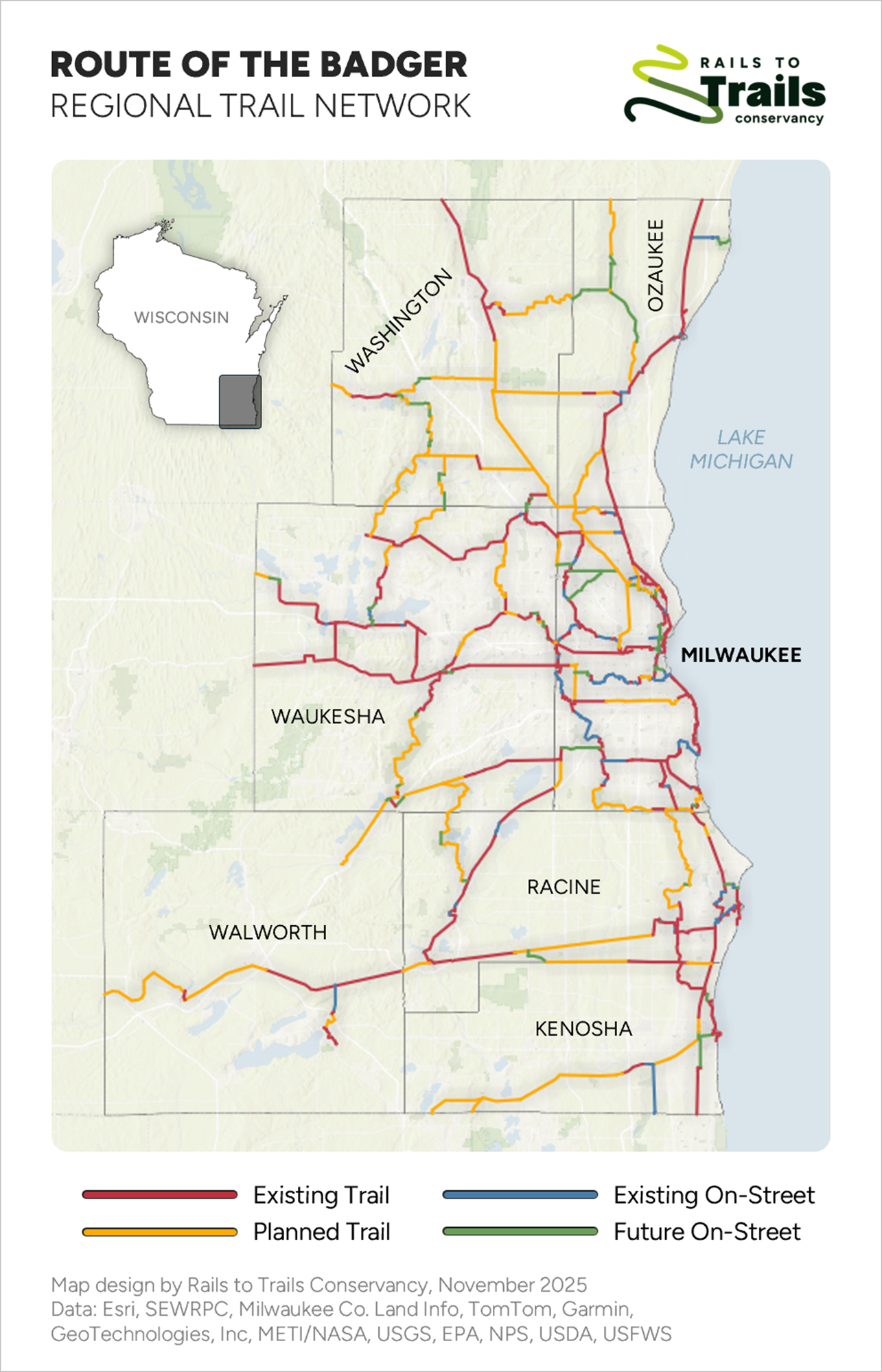
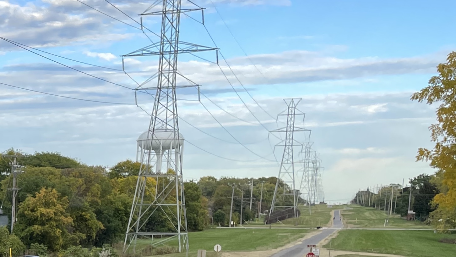
The Route of the Badger is a growing network of over 700 miles of trails linking city neighborhoods, suburbs, and rural areas across southeastern Wisconsin. For decades, communities in the region had individual trails, parks, and pathways, but these spaces didn’t connect. A key part of the solution has been partnerships among trail advocates, municipalities, and We Energies, the region’s electric utility. By opening trails such as the Powerline Trail in Greenfield, WI, these segments help connect the broader trail network by leveraging shared space with transmission corridors. Construction funding draws primarily from federal programs, such as the Congestion Mitigation and Air Quality (CMAQ) program, while local governments provide matching funds and handle routine maintenance.
What Are the Benefits of Recreation Services?
The trail network expands public access to greenspace and active transportation options across a multi-county region. By linking urban, suburban, and rural areas, the Route of the Badger provides recreational opportunities and supports non-motorized transportation for diverse communities. Co-locating trail segments within transmission corridors helps solve critical gaps in connectivity.
Who Was Involved?
Rails to Trails Conservancy
Rails to Trails Conservancy is a national nonprofit that helped launch the project as part of its TrailNation Initiative. It provided planning, support, outreach, and advocacy for the broader network vision.
WE Energies
We Energies is the regional electric utility that has supported trails and recreation in Wisconsin since the 1970s. WE Energies works with municipalities and project partners to develop shared use agreements that open utility corridors to recreation while maintaining access for the utility to maintain its power infrastructure.
Southeastern Wisconsin Regional Planning Commission
Southeastern Wisconsin Regional Planning Commission provides regional land-use and transportation planning frameworks that align cross-boundary connectivity across jurisdictions.
Additional Partners
Local municipalities, Wisconsin Bike Fed, and city-level planning entities have also been involved.
Key Project Takeaways
- Transmission corridors can help solve connectivity challenges. These corridors run continuously across the region, providing an ideal option for filling gaps between existing trails.
- Established utility-trail partnerships provide a replicable model. WE Energies and trail partners have worked together for decades, providing models for collaboration and practical agreements that outline requirements for corridor access and maintenance.
- Regional governance frameworks enable coordination. Regional planning helps align trail segments across municipal and county boundaries, ensuring broader network coherence.
- Phased implementation allows incremental progress. Building the network in segments enables communities to advance projects as funding and capacity allow, while contributing to a long-term regional vision.
- Federal funding is essential, but local capacity matters. Programs like CMAQ help cover construction costs, but communities still need staff, planning capacity, and matching funds to move projects forward.
- Ongoing monitoring supports adjustments over time. The region’s non-motorized count program provides a framework for tracking use as new segments are developed.