PNNL is a testbed for the latest research and technologies in marine carbon dioxide removal (mCDR)—leveraging the ocean’s strength as a natural carbon sink to address pressing climate concerns.
The Molecular Observation Network is a national open science network designed to produce a comprehensive database of molecular and microstructural information on soil, water, microbial communities, and biogenic emissions.
PNNL's Ocean Dynamics Modeling group studies coastal processes such as marine-hydrokinetic energy, coastal circulations, storm surge and extreme waves, tsunamis, sediment transport and nutrient-macroalgal dynamics.
PNNL wind energy experts are helping to design a new avian radar system that will be equipped on lidar buoys to detect avian activity over open water and near offshore wind turbines.
Physics-informed machine learning (PIML) is a modeling approach that harnesses the power of machine learning and big data to improve the understanding of coupled, dynamic systems.
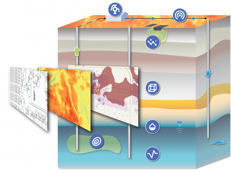
PREPARES demonstrates linkages between climate or weather conditions and human domain systems by combining quantitative geophysical data with qualitative data.
PNNL has developed performance assessment guidance for remediation of volatile contaminants in the vadose zone, inorganic contaminant remediation in the vadose zone, and pump-and-treat of groundwater contaminant plumes.
PNNL's River Corridor Hydrobiogeochemistry Scientific Focus Area works to transform understanding of spatial and temporal dynamics in river corridor hydrobiogeochemical functions from molecular reaction to watershed and basin scales.
The Salish Sea Model (SSM) is a predictive coastal ocean model for estuarine research, restoration planning, water-quality management, and climate change response assessment.
The Suite Of Comprehensive Rapid Analysis Tools for Environmental Sites online tools provide rapid data analytics and visualization of environmental data supporting remedy decisions, optimization, and exit strategies.
STOMP is a suite of numerical simulators for solving problems involving coupled flow and transport processes in the subsurface. The suite of STOMP simulators is distinguished by application areas and solved mathematical equations.
PNNL researchers developed and manage the online database Tethys to actively collects and curates information on the environmental effects of wind and marine energy.
The TRAC web tool displays the environmental remediation status—and metrics about progress toward closure—for cleanup sites overseen by the DOE Office of Environmental Management.
The UNSAT-H computer code is used to understand the movement of water, heat, and vapor in soils so more informed decisions can be made about land use, waste disposal, and climate change.