TRAC: Tracking Restoration And Closure

The TRAC web tool displays the environmental remediation status—and metrics about progress toward closure—for cleanup sites overseen by the DOE Office of Environmental Management
TRAC: Tracking Restoration and Closure title graphic

The Tracking Restoration And Closure (TRAC) tool enables information sharing about and provides transparency into environmental remediation progress at Department of Energy Office of Environmental Management (DOE-EM) sites nationwide.
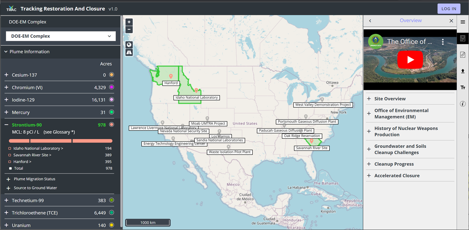
Tracking Restoration And Closure (TRAC) is a web-based application that combines infographics, annual statistics, and historical facts to clearly communicate the current status of groundwater contamination cleanup efforts at Department of Energy Office of Environmental Management (DOE-EM) sites across the nation. TRAC is a tool to share information about and provide transparency into environmental remediation progress at these cleanup sites.

See how the Tracking Restoration And Closure (TRAC) application works in this demonstration video by Chris Johnson, senior development engineer at Pacific Northwest National Laboratory.

With TRAC, users can explore robust and consistent geospatial visualization of contaminants of concern above the regulatory cleanup concentrations. Unlike a traditional written report, TRAC provides explanatory text, photographs, video, contaminant plume graphics, and tabular metrics on cleanup progress. Metrics are displayed for three categories of information:

  • contaminant plume (e.g., technetium-99),
  • regulatory context/status, and
  • remediation technology approach (e.g., pump-and-treat).  

In addition to tracking remediation progress, TRAC is an online information resource that promotes the sharing of technologies, successes, and lessons learned across the DOE-EM complex by providing a single, consistent framework for integrating and standardizing information among EM sites. TRAC facilitates effective communication about progress toward site closure between DOE-EM sites and Headquarters, and with regulators and stakeholders.

TRAC v. 1.0 was released in October 2022 with full data for the Hanford Site in Washington state, the Savannah River Site in South Carolina, and the Idaho National Laboratory. Information on seven additional DOE-EM sites is being compiled and reviewed, and is expected to be available by January 2023. Each site will update its data annually.

Map of the Department of Energy Office of Environmental Management Complex
The DOE Office of Environmental Management is responsible for the cleanup and closure of legacy nuclear waste sites and is charged with the largest environmental cleanup program in the world. The interactive maps in TRAC share data on active EM groundwater cleanup sites across the nation, showing information and metrics on the status of remediation efforts and progress toward site closure. The sites shown in green are those for which data is currently available in the tool. Data for the remaining sites will be added soon.

TRAC can be accessed at https://trac.pnnl.govGeneral users can bypass the login to continue as a Guest (the login is for authorized users).

For more information about TRAC, contact:

Chris Johnson
Senior Development Engineer, Pacific Northwest National Laboratory
Advisor, Center for the Remediation of Complex Sites (RemPlex)
cd.johnson@pnnl.gov | 509-371-7096

Latrincy Bates
Physical Scientist, Office of Subsurface Closure, DOE Office of Environmental Management
latrincy.bates@em.doe.gov | 301-903-7654