Storm Surge
Coastal zones are subject to the risks of coastal inundation and flooding induced by episodic extreme events, such as tropical and extratropical cyclones and river floods, as well as long-term sea level rise due to global warming. The Ocean Dynamic Modeling group develops coupled modeling frameworks to simulate and predict the coastal flooding processes under different forcing mechanisms and provide high-resolution data sets to support coastal resilience and mitigation of extreme flooding.
Projects
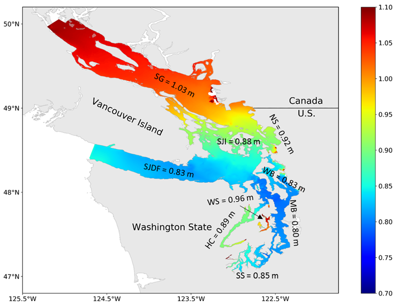
Predicting Storm Surge and Extreme Waves in the Salish Sea. This project assessed the storm surge and extreme wave characteristics to support coastal resilience in the Salish Sea using a high-resolution coastal model. Model results suggested that the maximum storm surge in the Salish Sea is generally in the range of 0.8 m to 1.03 m and is highly heterogeneous in space. Model results also suggested that the Strait of Juan de Fuca has the largest waves and is dominated by swells propagated from the Pacific Ocean, while waves in Puget Sound are small and primarily dominated by the wind-sea climate.

Simulating Storm Surge and Coastal Inundation in the Gulf of Mexico Using a Regional Integrated Assessment Modeling (RIAM) Approach. In this study, a coastal storm surge model was developed to simulate coastal inundation in the Gulf of Mexico. The storm surge model was forced with a series of sea surface wind fields, from re-analysis to dynamic downscaling, to assess the vulnerability of coastal energy infrastructure under extreme events and future climate scenarios.

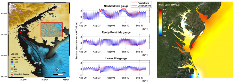
Coupled Modeling of Coastal Flooding in the Delaware Bay Estuary. Low-lying coastal areas in the mid-Atlantic region are prone to compound flooding resulting from the co-occurrence of river floods and storm surges. This project aims to investigate the effects of compound flooding and nonlinear interactions between various forcing mechanisms in the Chesapeake–Delaware Bay system using a high-resolution unstructured-grid coastal ocean model, FVCOM. The FVCOM model will be further coupled with the DHSVM hydrological model and the urban flooding model RIFT to evaluate the risk of extreme events on urban infrastructure in future climate conditions.
