
As PNNL implemented numerous sub-basin scale models within Puget Sound over a period from 1997 through 2003, it became clear that simulation of hydrodynamic circulation and water quality in Puget Sound sub-basins would be best conducted using a region wide model to ensure accounting of inter-basin exchange and elimination of errors associated with boundaries in close proximity of the river plume mixing zones. However, accomplishing this goal using popular structured grid models was a challenge due to the complexity of the Puget Sound shoreline, with its deep bathymetry with steep side slopes and the presence of several mid-Channel Islands. By mid-2000s, finite volume methods became available and tools such as Finite Volume Community Ocean Model (FVCOM) with excellent mass conservation capability and the ability to operate in parallelized mode on a multi-processor Linux cluster made the objective of a Puget Sound-Wide Model attractive and feasible.
PNNL initially began applying FVCOM on several projects within the Whidbey Basin of Puget Sound, mostly funded by Salmon Restoration Funding Board and Estuary Salmon Restoration and Protection grants from 2003-2007. In 2007, through an internally funded Laboratory Directorate Research and Development (LDRD) grant, the effort to develop a Puget Sound wide model was initiated. Subsequently, the model development was supported by U.S. EPA through a National Estuary Program grant.
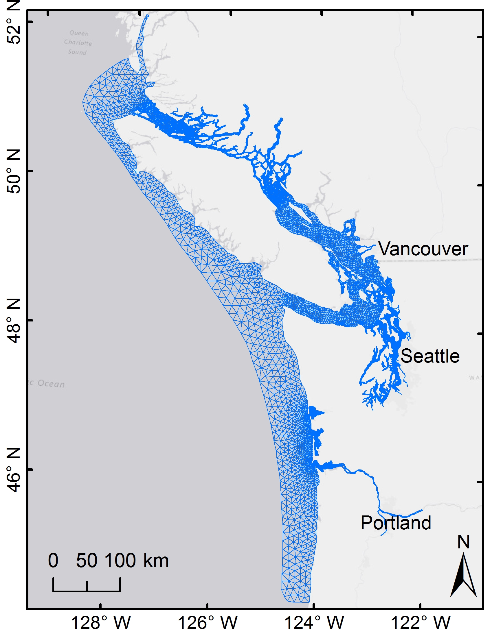
From 2009 through 2012, PNNL developed the Puget Sound Model (PSM) in collaboration with Washington State Department of Ecology with funding from U.S. EPA. The Puget Sound Model boundaries were set at the entrance to the Strait of Juan De Fuca to the west and at the entrance to Georgia Strait to the north. Since the domain covered Puget Sound and Georgia Strait including the Straits surrounding San Juan Islands, collectively known as the Salish Sea, the name of the model was updated to the Salish Sea Model (SSM).
From 2012 through 2016, PNNL continued efforts to improve the model capabilities. Specifically, sediment diagenesis and carbonate chemistry modules were added. In 2017, PNNL also expanded the model domain to the continental shelf and encompassed Vancouver Island to the north and included Columbia River and Yaquina Bay in Oregon to the south.
As a result of these improvements, a robust diagnostic model of the Salish Sea has now been established with the ability to reproduce characteristic oceanographic features such as two-layer density-driven circulation and exchange with Pacific Ocean and annual biogeochemical cycles of algal growth, nutrient consumption, pH, and dissolved oxygen response. A milestone accomplishment of the model in 2018 was the ability to reproduce observed hypoxia in Hood Canal and other sub-basins such as Penn Cove and East Sound while maintaining healthy DO levels in other parts of Puget Sound.