E4D
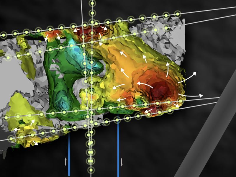
A scalable, 3D geophysical modeling and inversion code that uses geophysical measurements to generate images that serve as indicators of subsurface contaminant distributions, injection delivery extent, and dynamic biogeochemical processes.
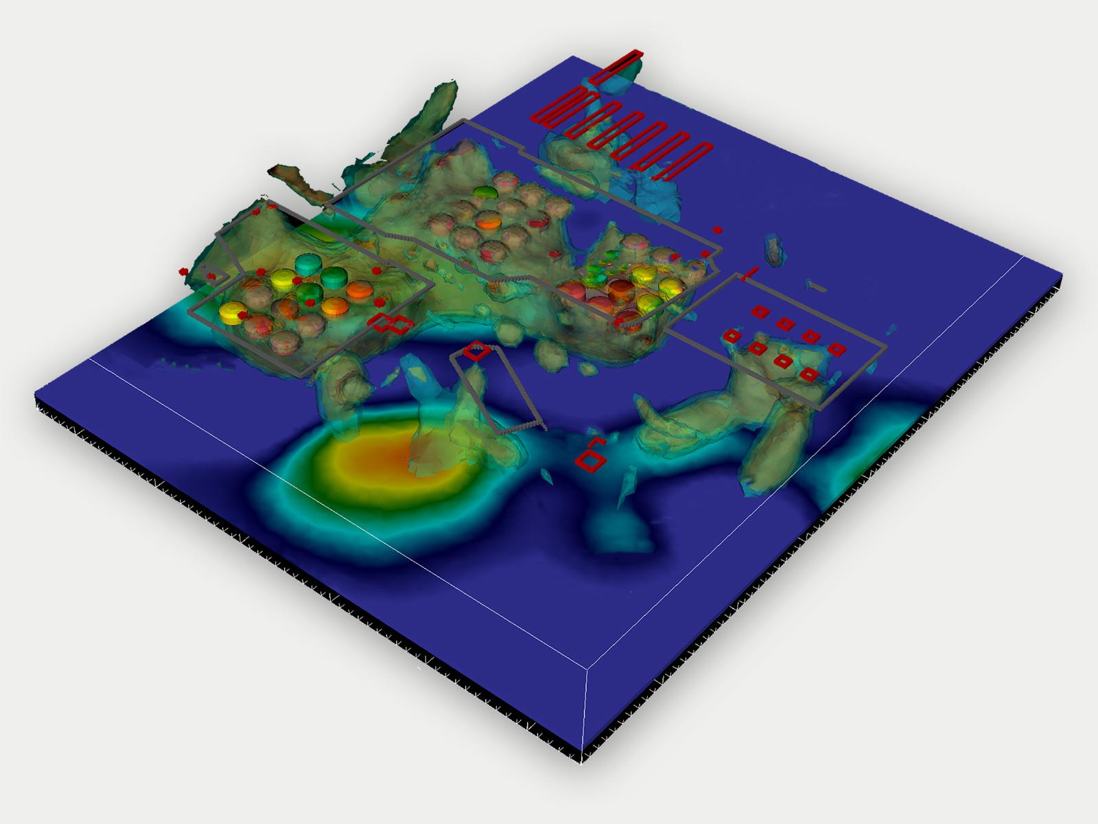
E4D uses electrical resistivity tomography (ERT) measurements to reconstruct time-lapse images of the electrical conductivity of the soil.
E4D is a 3D geophysical modeling and inversion program designed for subsurface imaging and monitoring. This award-winning R&D 100 E4D software provides customization for a wide range of field and laboratory applications, using:
- Static and time-lapse electrical resistivity tomography (ERT)
- Spectral induced polarization (SIP)
- Travel-time tomography
High-Performance Computing Capabilities
E4D leverages distributed-memory high-performance computing, providing solutions for analyzing large geophysical datasets with high computational demands. E4D is highly scalable, and can be used on systems ranging from laptop computers to state-of-the-art supercomputing systems. The largest inversion executed to date involved a data set with approximately 5000 electrodes, 220,000 measurements, and a mesh with approximately 3 million elements, executed on NERSC supercomputing resources using 10,000 processors.

Sponsors
U.S. Department of Energy
- Office of Environmental Management: Headquarters, Richland Operations, Office of River Protection
- Office of Science: Subsurface Biogeochemical Research Program
U.S. Department of Defense
- Environmental Security and Technology Certification Program