February 6, 2019
Feature

Imaging Goes Underground at the Hanford site

PNNL's award-winning E4D imaging software helps monitor uranium cleanup progress

PNNL electrical resistivity tomography tanks

Surrounded by storage tanks and injection hoses, PNNL's E4D subsurface imaging technology monitors the delivery of a phosphate solution for binding contaminants in the soil at the Hanford Site's 300 Area near the Columbia River.

Andrea Starr | Pacific Northwest National Laboratory

At the southern tip of the sprawling Hanford Site, the soil beneath the 300 Area(Offsite link) 
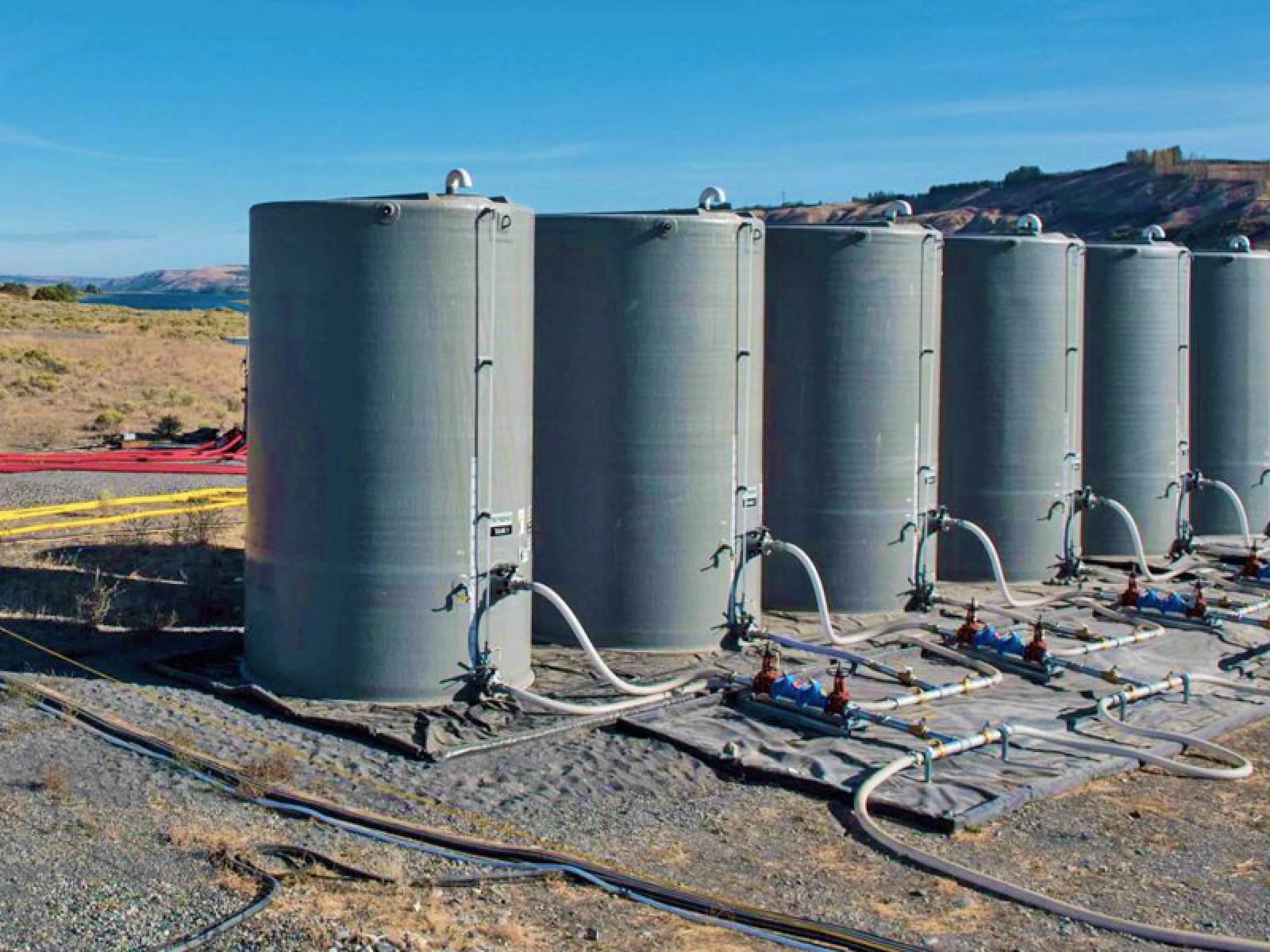
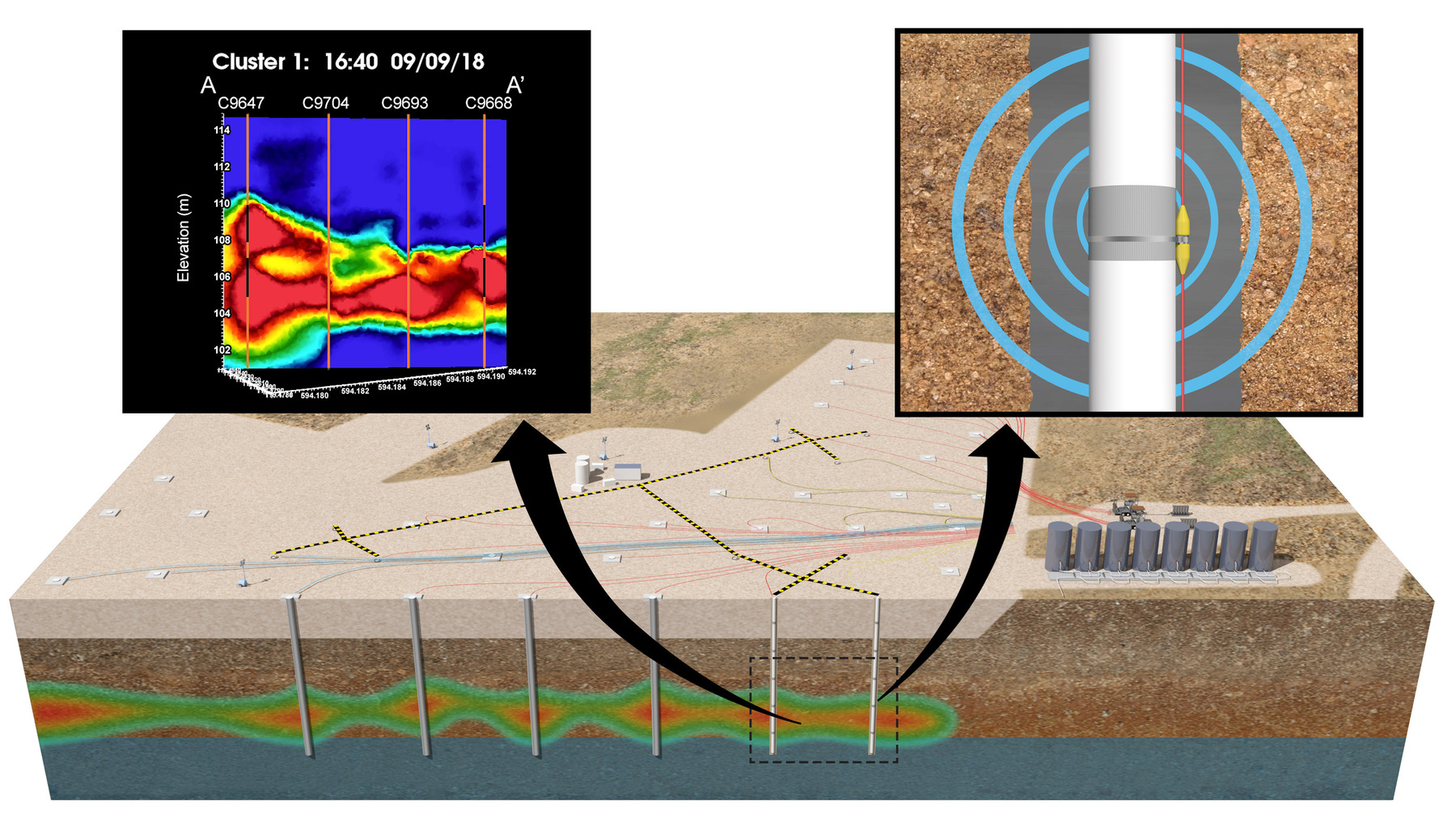
contains residual uranium from a handful of now-removed settling ponds and trenches that stored liquid waste from the processing of spent nuclear fuel rods. Located about a quarter-mile west of the Columbia River shoreline, underground uranium concentrations remain high after years of plutonium production.

The Department of Energy Richland Operations and its site contractor CH2M HILL Plateau Remediation Company (CHPRC) recently finished injecting an approved polyphosphate solution into the ground that will bind with uranium through a process called sequestration, preventing the uranium from reaching the groundwater and Columbia River.

PNNL researchers worked with CHPRC to successfully implement a state-of-the-art approach for monitoring the delivery of the polyphosphate remediation action. The approach used PNNL’s Real-time Four-Dimensional Subsurface Imaging Software, or E4D, to image the vertical and lateral movement of the polyphosphate solution.

E4D uses electrical resistivity tomography (ERT) measurements to reconstruct time-lapse images of the electrical conductivity of the soil. As the polyphosphate solution permeated the soil and the ground’s electrical conductivity increased, an array of ERT sensors continuously measured the change in conductivity. E4D uses the measurements to produce images of the polyphosphate remedy distribution over time.

Tim Johnson headshot
Tim Johnson

“It’s sort of like using infrared goggles to see heat signatures in the dark, except this is underground—there is no direct line of sight,” said Tim Johnson(Offsite link), senior geophysicist at PNNL and lead developer of the E4D software. “With E4D, data collected by remote sensors are processed by a computer tomography algorithm to produce an image that reflects the environment.”

Results in Real Time

The polyphosphate remedy, delivered at two depths from a patchwork of 48 total injection wells, spread through the soil. To help the site contractor “see” the spread of the phosphate solution underground, PNNL placed its ERT sensors in a unique cross-hole pattern within clusters of injection and monitoring wells.

During the phosphate solution injections, the ERT system injected electrical current into the subsurface. Sensors running the length of each well measured the corresponding changes in soil voltage.

Those measurements instantly traveled via wireless internet to Constance, a supercomputer at PNNL’s Institutional Computing Center. There, Constance began processing the data, combining geology, physics, mathematics and chemistry with E4D’s sophisticated modeling software to create time-lapse three-dimensional images of the solution and its location—all within minutes.

As the E4D software executed its program, color-coded pools quickly began appearing on the display. Through a custom web interface, the science team, operations staff and key stakeholders at multiple locations watched the mobility of the phosphate solution in near real-time—the fourth dimension in E4D.

Within minutes of data acquisition, the E4D modeling software translated that information into images for onscreen display.

Crosssection of earth with pipes below the surface

“We really appreciate the collaboration with PNNL on being able to use this technology,” said Marty Doornbos, CHPRC’s director of groundwater remedy selection and implementation. “It allowed us to monitor and verify the progress in real time to help ensure we reduce this risk to the Columbia River.”

Breathing Life into the Data

Over the course of three weeks, the compiled images revealed a noticeable “breathing” pattern. The colored pools appeared as the injections took place during the day shift, then tapered off overnight, then reappeared as injections started again the next day.

“Right off the bat it looked like the new monitoring technique was working as well as or better than expected,” said Rob Mackley(Offsite link), a hydrogeologist at PNNL and manager of PNNL’s technical support on the project. “After two weeks of data, we knew it was a home run.”

E4D(Offsite link) was developed with support from the U.S. Department of Energy and the U.S. Department of Defense and is freely available to anyone. In 2017, R&D Magazine(Offsite link) named it one of the 100 most innovative scientific breakthroughs of the year.

###

About PNNL

Pacific Northwest National Laboratory draws on its distinguishing strengths in chemistry, Earth sciences, biology and data science to advance scientific knowledge and address challenges in sustainable energy and national security. Founded in 1965, PNNL is operated by Battelle for the Department of Energy’s Office of Science, which is the single largest supporter of basic research in the physical sciences in the United States. DOE’s Office of Science is working to address some of the most pressing challenges of our time. For more information, visit https://energy.gov/science. For more information on PNNL, visit PNNL's News Center. Follow us on Twitter, Facebook, LinkedIn and Instagram.