April 21, 2020
Feature

Beneath It All

Subsurface science, practiced in hidden layers of sediment and rock from an inch to hundreds of feet deep, gives Earth Day an underground spin

Earth illustration - South America

PNNL celebrates the discovery of how the Earth works—from plants to the atmosphere, and from subsurface zones to coastal areas.

Composite illustration by Timothy Holland | PNNL

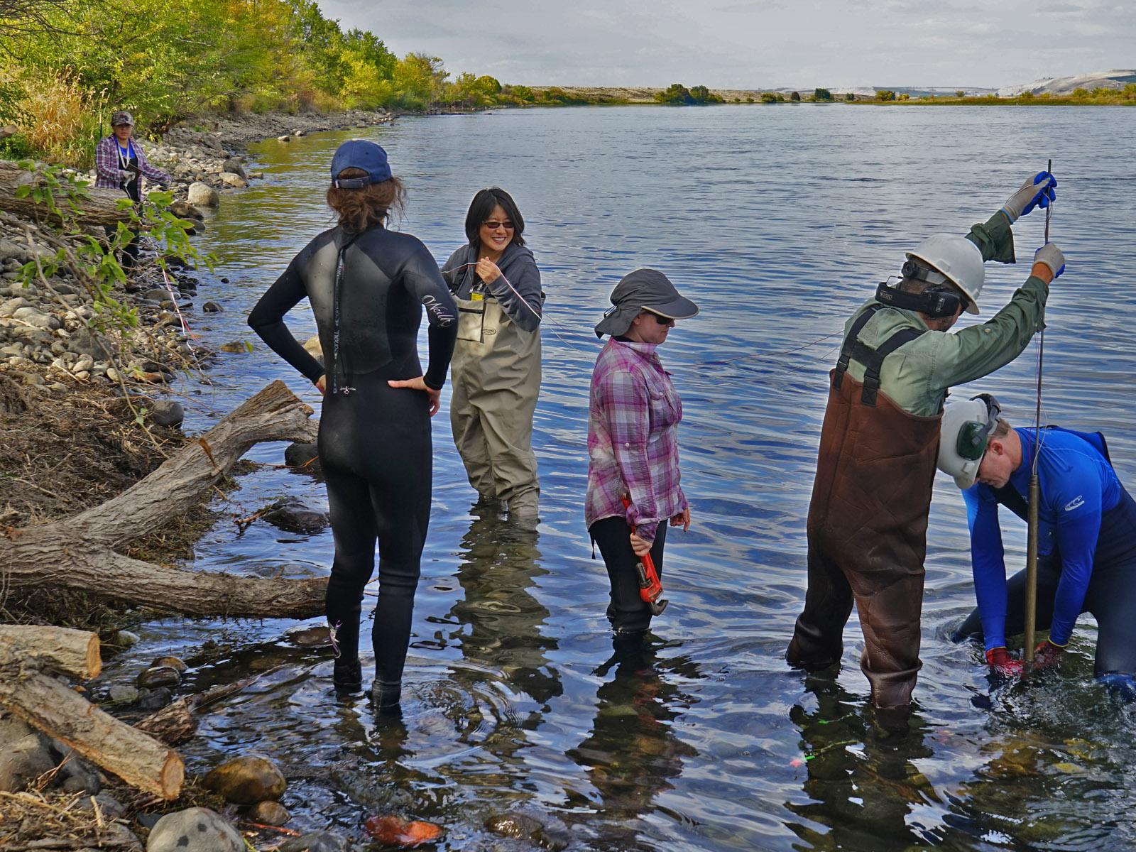
Researchers taking samples in the river
PNNL ecologist James Stegen, right, joins his team in taking samples along the Columbia River. Subsurface science, he says, expands “the breadth of how we think about the Earth.” (Photo by John Zachara, PNNL.)

An ever-shrinking number of people remember the first Earth Day on April 22, 1970―50 years ago―when 22 million Americans gathered to protest worsening levels of air, water, and terrestrial pollution. Several generations of scientists since then have stepped up to investigate, monitor, and protect the planet we inhabit. Among them are researchers at Pacific Northwest National Laboratory who specialize in subsurface science and its critical interactions with other Earth systems.

At PNNL, subsurface science inhabits two separate but interlocking worlds. One looks at basic science, the other at applied science and engineering. Both are funded by the U.S. Department of Energy (DOE). Both also have programmatic obligations to discover, develop, and share knowledge of the subsurface with the DOE, as well as the world at large. That means systematic collaborations across PNNL’s disciplinary boundaries.

“There’s a lot of overlap in staff, methods, and technologies to interrogate the subsurface,” says Vicky Freedman, who on the applied side of PNNL subsurface science manages the Laboratory’s Deep Vadose Zone program, as well as its Soil and Groundwater program. “Our research may not be exactly the same, but there is a lot of synergy.”

The vadose zone, located between the Earth’s surface and groundwater, is an unsaturated layer of rock that forms a filtering, protective layer over groundwater and aquifers. Because groundwater can go as far down as several hundred feet, it is called the “deep vadose zone.” The programs Freedman leads are funded by DOE’s Office of Environmental Management, the federal arm charged in 1989 with cleaning up contaminated Cold War sites.

One of them is just north of the PNNL campus. The DOE Hanford Site is a former nuclear production facility that was active from World War II until the end of the Cold War. Plutonium-239 for the world’s first nuclear bomb was made there.

Living Laboratories

On the applied side of PNNL subsurface science, Hanford is a living laboratory for efforts to characterize, monitor, and mitigate legacy contaminants that exist in the subsurface at Hanford and other legacy sites throughout the industrialized world.

On the basic science side, another living laboratory is the Columbia River, which threads through both PNNL and the Hanford Site, and interacts with the subsurface that the applied program works to cleanup. The missions for both programs include the protection of the Columbia River.

Its subsurface, shoreline, and hyporheic zone (where groundwater and surface water mix) provide opportunity for research by scientists at PNNL’s Subsurface Biogeochemical Research (SBR) program, which is funded by the DOE’s Office of Biological and Environmental Research. The SBR’s principal investigator is PNNL Earth scientist and Laboratory Fellow Timothy Scheibe, whose main co-investigators are ecologist James Stegen and Earth scientist Xingyuan Chen.

Chen creates models of the subsurface interacting with rivers, including models of the subsurface at the Hanford 300 Area. She and her researchers study water movement throughout the Hanford Site and the larger watershed. They focus on the shallow vadose zone and the saturated zone close to the river, where the water table is at ground level.

“It’s very hard to get the full details of permeability,” says Chen, “but that’s crucial to understanding how water moves in and out of the system.”

Scheibe’s team studies the interactions between river water and groundwater, “which have important implications for the kind of things people care about,” says Scheibe; this includes water quality―a reminder on the eve of the 50th Earth Day. “We share a lot of methodologies and data (with the applied side). At the highest level, we’re both working on things that protect the river.”

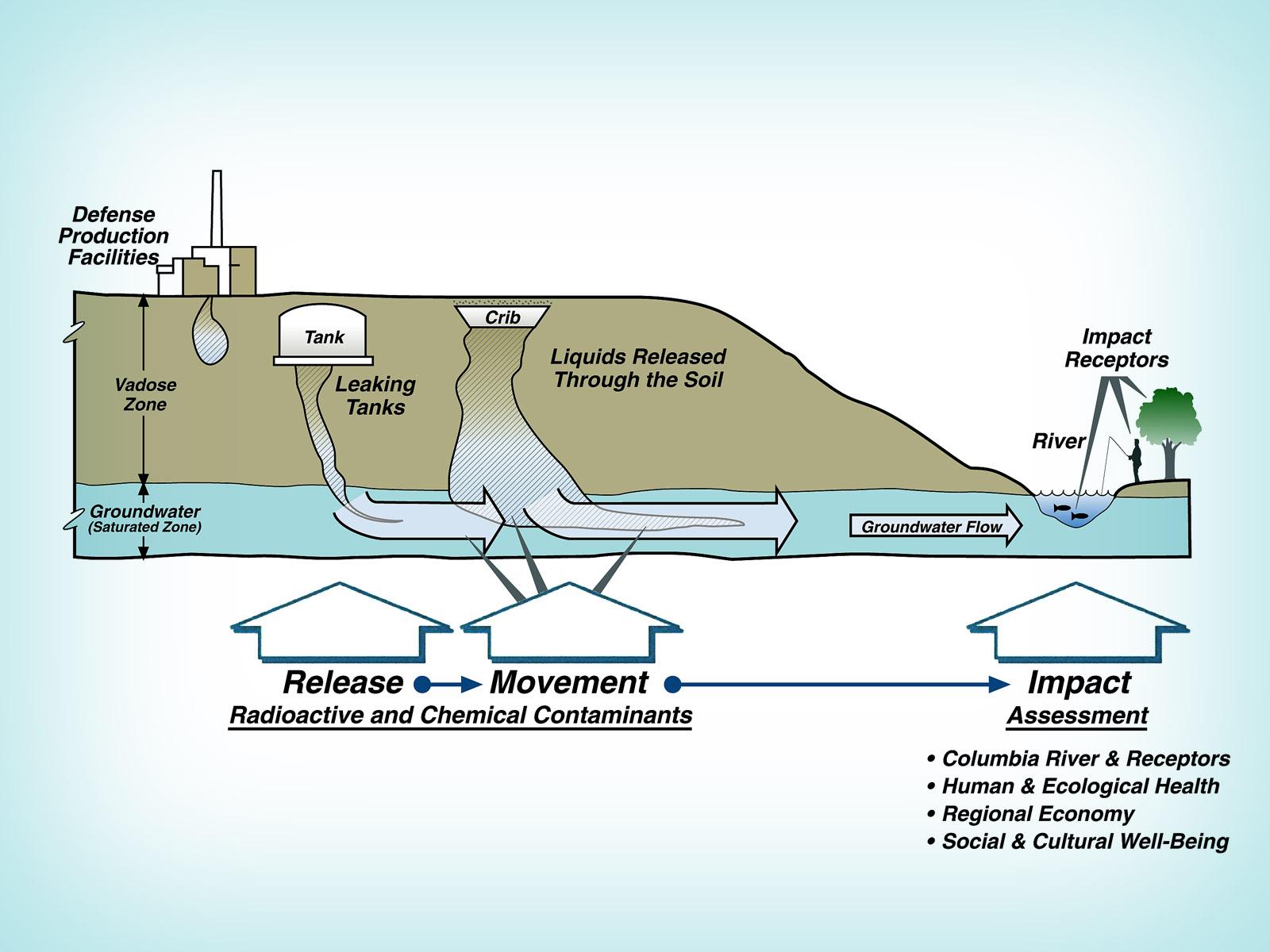
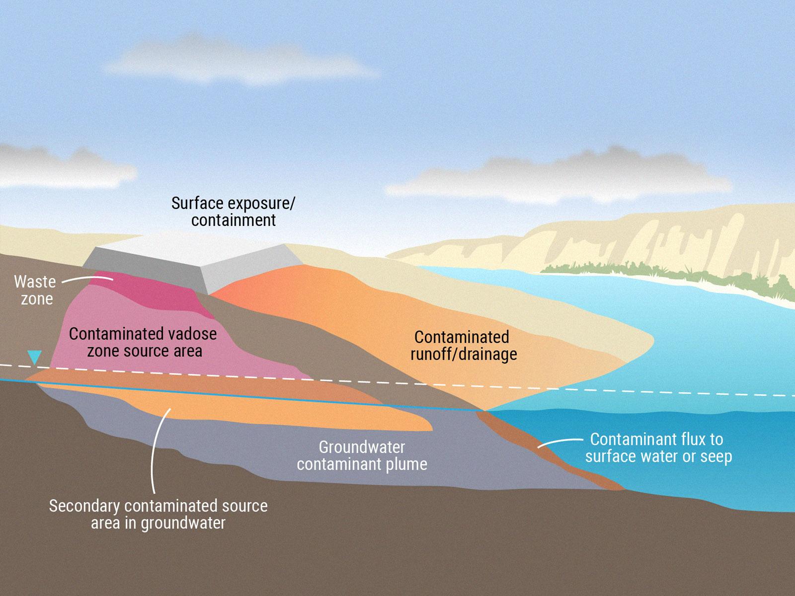
Image of how contamination moves through the subsurface environment.
How radioactive and chemical contaminants could impact rivers, water quality, and human uses. (Graphic is courtesy of Vicky Freedman.)

Subsurface Power and Influence

Studying what lies beneath Earth’s surface is a path of inquiry at PNNL that runs alongside other Laboratory research priorities, including investigations of the atmosphere, plants, coastlines, ecosystems, and terrestrial aquatics. Any one of these would make a good Earth Day story. But the subsurface―a hidden and consequential planetary realm replete with its own below-surface habitats and biodiversity―has special power.

This hidden region stores 90 percent of Earth’s fresh water and 80 percent of the world’s energy in the form of oil and gas. The subsurface supports a soil and root zone that, when coupled with the atmosphere, is the most important linked ecological realm on Earth for sustaining life.

The world beneath the surface also holds, by a vast margin, most of the planet’s biodiversity. A single pinch of healthy soil from the root ball of grass contains billions of organisms, thousands of species, and threads of fungal hyphae measured in miles. Much of this diversity remains as uncharted as the stars in deep space.

Collectively, the soils, sediments, seeps, and microbial life within the subsurface provide untold ecosystem services, including nutrient cycling, water purification, and soil stabilization. Groundwater within the subsurface also supplies drinking water, irrigation water, and can be a source of recharge for lakes, rivers, and wetlands.

“I think about our science as expanding the breadth of how we think about the Earth and how we should be caring for it,” says Stegen.

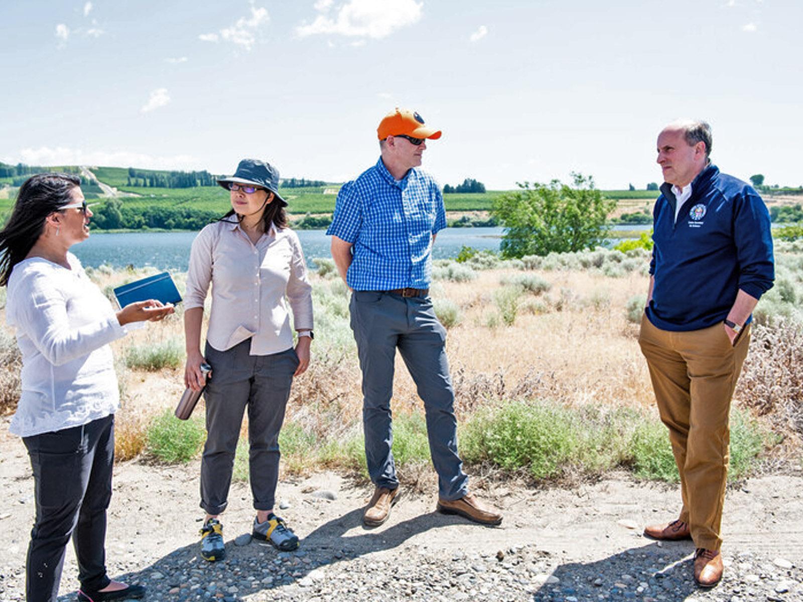
PNNL staff speak with DOE Undersecretary Paul Dabbar
In the summer of 2019, PNNL subsurface scientists Vanessa Bailey, Xingyuan Chen, and James Stegen (left, center left, and center right) toured the Columbia River shoreline with DOE Under Secretary for Science Paul Dabbar (far right). They discussed critical interaction between surface water and groundwater in the subsurface. (Photo by Andrea Starr, PNNL.)

Location, Location, Location

Still, the subsurface faces risks and harbors threats. Its hydrological processes are perturbed by dams, droughts, and floods, for example. It holds contaminants in ground and surface waters that migrate through the subsurface in ways scientists are eager to investigate to protect human and ecosystem health. One important highway for those contaminants is groundwater, which is investigated by scientists in both the basic and applied sides of PNNL subsurface science. (On the basic side, scientists study groundwater as a pathway for nutrients.) Stored in the cracks and spaces in soil and rock, groundwater moves slowly through geologic formations called aquifers and often interacts with bodies of water at the surface.

Both PNNL subsurface science programs share advantages of location. The Columbia River enables investigations of groundwater and surface water exchange. On the applied side of science, Freedman’s group supports remediation at the Hanford Site. Soil and groundwater cleanup is managed by DOE’s Richland Operations Office.

Hanford, just north of the PNNL campus, contains below-ground contaminants that are remnants of former plutonium production. Freedman’s group provides the technical basis for studying the fate of subsurface contaminants and to prevent them from migrating to the nearby Columbia River. The sprawling site, half the size of Rhode Island, is dominated by a central plateau high above the groundwater table. Plutonium-239 for the first nuclear bomb was made at there and for such 60,000 weapons afterward: 61 tons of plutonium in all. (In 1942, only a gram of the new element existed. A paperclip weighs 1 gram.)

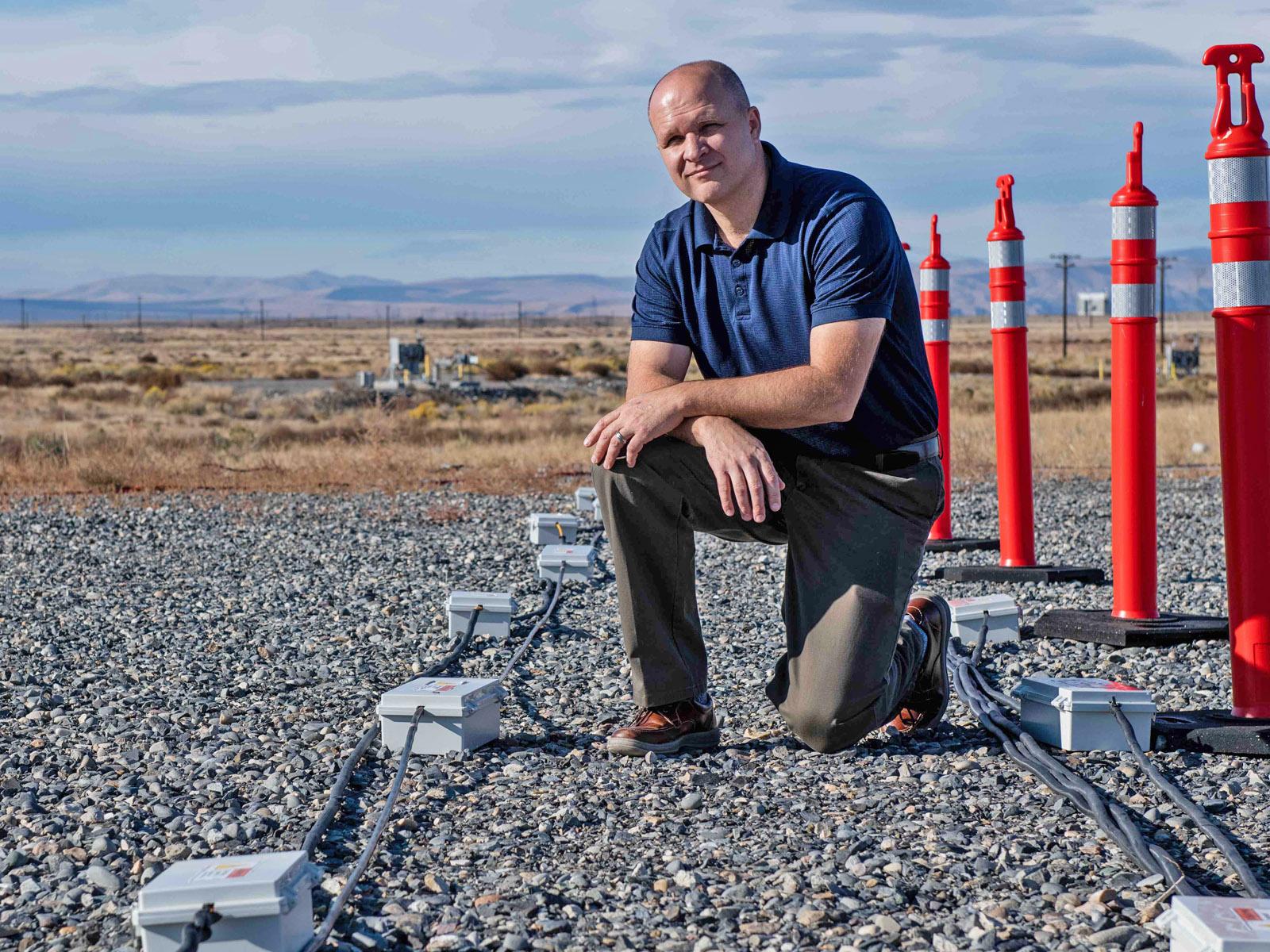
Photo of Timothy Johnson in Hanford's 100-H area
PNNL geophysicist Timothy C. Johnson, who works in both the basic science and applied realms of PNNL subsurface science, poses along an array of probes in the Hanford Site’s 100-H Area. They are staged for an electrical resistivity tomography experiment being performed under PNNL’s Deep Vadose Zone project. (Photo by Andrea Starr, PNNL.)

Matters of Scale

In both basic science and applied programs, scientists study the subsurface through entities as small as a molecule by using microscopy technologies available at EMSL, the Environmental Molecular Sciences Laboratory, a DOE science user facility located on the PNNL campus.

“Even super-applied projects still need to look down at the molecular level,” says 31-year PNNL geochemist James Szecsody, whose research on environmental cleanup technologies often bring together experts in geochemistry and microbiology. “We need people with a lot of skills to get something to work right.”

Subsurface studies can begin less than an inch beneath the ground. PNNL quantitative ecosystem scientist Emily Graham, for instance, says such work could begin “in the top 2 centimeters” of the surface in the case of the headwaters of a stream. That’s about 7 tenths of an inch.

Close to a large river, the area of study extends tens of feet. In the Hanford Central Plateau, located a few miles from the Columbia River, the area of study extends hundreds of feet down, because groundwater is located so deep below Earth’s surface.

The Black Box

In most cases, subsurface science at PNNL (as everywhere) takes place in a kind of terrestrial black box―that is, in places difficult to visualize and measure.

“It’s hard to see under the ground, so most people don’t realize what’s going on there,” says Timothy C. Johnson, a senior geophysicist at PNNL.

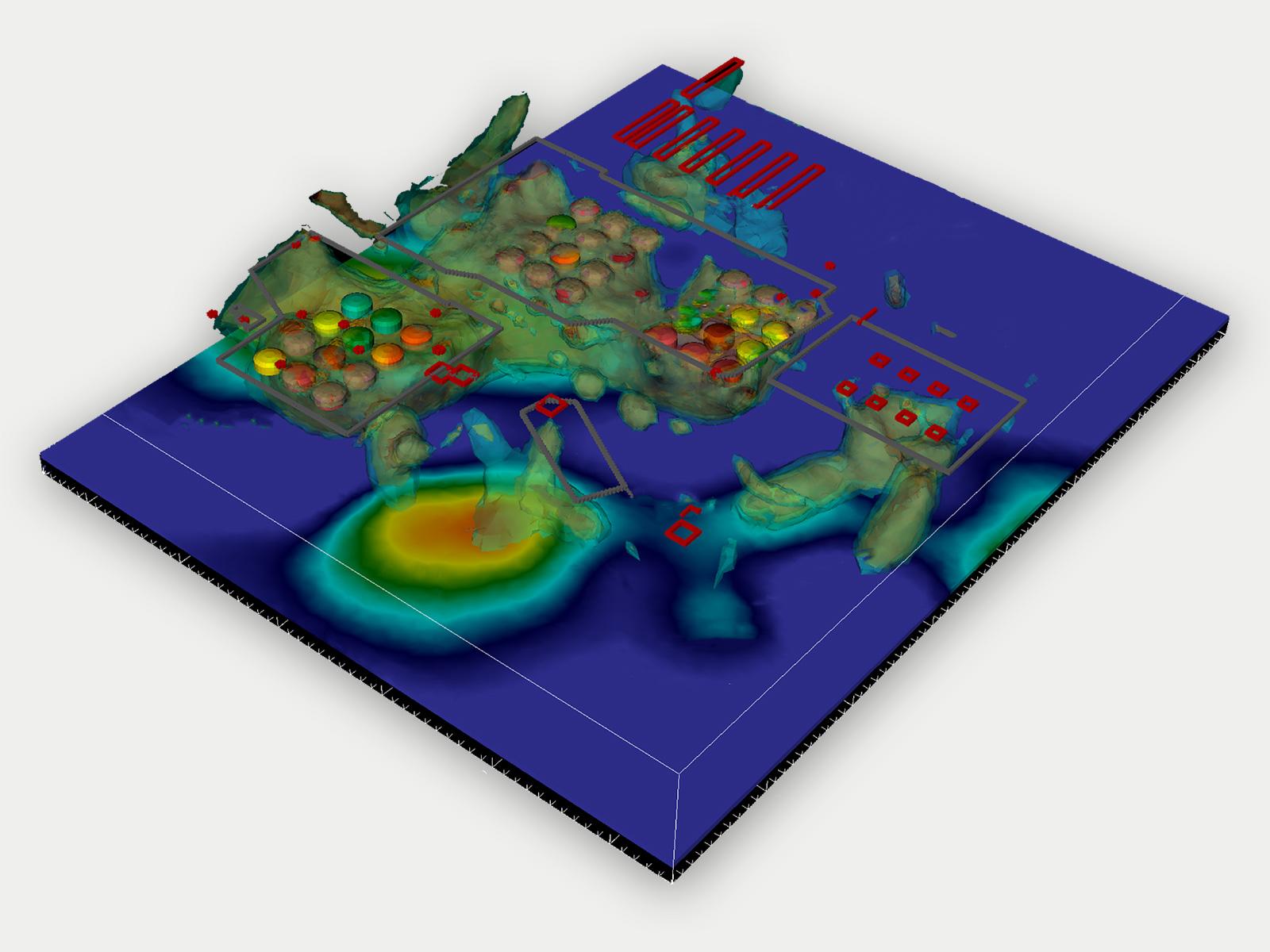
Using electrical resistivity tomography (ERT), Johnson is able to “see” into the subsurface by using a four-dimensional modeling and inversion code called E4D, which he invented and wrote. The software allows for ERT measurements to be translated into time-lapse images of water and contaminant distributions. (ERT is sensitive to changes in the ionic strength of fluids in the subsurface.)

Combined, ERT and E4D can visualize underground conductivity, which imparts physical and chemical clues. They provide time-lapse images of tracer injections, capture riverine groundwater intrusions, and show contaminant distributions in subsurface soils.

Image of a ERT model
A Hanford Site B-Complex ERT image. In general, researchers can’t directly see contaminants with ERT. But in the deep vadose zone at the Hanford Site’s B-Complex, contaminant concentrations are so high they change the electrical conductivity of the subsurface and can be imaged using ERT.

Watersheds

The ecologically connected region influencing the river also informs the SBR’s strong focus on watershed science.

One part of that is an ambitious international project directed by Stegen, the Worldwide Hydrobiogeochemical Observation Network for Dynamic River Systems (WHONDRS). Using hundreds of sites on six continents, it pairs a rolling sampling program with public data on river corridors around the world.

The global-scale physical, chemical, and biological watershed project is collecting and archiving data processes on watershed at a global scale. It’s a growing bonanza of interoperable measurements―seven more datasets added in the last six months alone―is starting to be widely analyzed and has inspired an EMSL summer school slated for July.

From Graham’s microbiome inquiries to Stegen’s sprawling watershed project, Scheibe calls this confluence of resources ready to study ideal for investigating the subsurface.

Diagram of the subsurface terrain
This graphic shows the top-down dynamics of subsurface contamination. In nature, the vadose zone is an unsaturated area above the groundwater. (Graphic by Nathan Johnson, PNNL.)

Overlapping Staff and Methods

On the applied side, PNNL researchers design and test solutions to subsurface issues.

In the deep vadose zone, any water in the deep vadose zone is “capillary-bound,” says PNNL geophysicist Christopher Strickland, which presents a monitoring and sampling challenge deeper into the subsurface than the depths that builders and farmers care about. “We’re looking for contaminants not normally studied and ways to bind them up.”

Innovative approaches for “seeing” contaminants in the subsurface is a critical component of remediation. The subsurface area defined as the deep vadose zone “is very complicated,” says PNNL hydrogeologist Rob Mackley, who studies the underground migration of hexavalent chromium, a legacy contaminant used to prevent corrosion in nuclear reactors. “The processes are dynamic, especially in groundwater systems near a river boundary. They are also sometimes slow. And you can’t see them.”

Mackley describes the basic mission of Freedman’s group: “Focus on the cleanup mission, support the contractors, and meet the needs of DOE.”

PNNL’s subsurface science programs, both basic and applied, he adds, “are asking different questions, but the hydrogeological system is the same.”

Sharing Knowledge

In the two groups, there is also an ethic of sharing knowledge with those in need of it outside the Laboratory.

WHONDRS is a way to transfer PNNL data-collection protocols to the wider world. In a similar way, Freedman’s team contributes to a corollary knowledge-transfer mechanism: PNNL’s Center for the Remediation of Complex Sites (RemPlex), a platform directed by Dawn Wellman, director of the Laboratory’s Earth Systems Science Division.

RemPlex, a forum that supports multidisciplinary approaches for the remediation of complex sites, shares expertise in subsurface characterization and remediation science and design. It supports remediation strategies across the DOE landscape, restoring contaminated sites and protecting natural resources worldwide.

There are other ways of sharing too.

For instance, remediation technologies developed at PNNL and used at Hanford―which often evolve from the scale of a beaker to that of a field site―have helped remediate contaminated sites elsewhere in Washington State, as well as in California, Colorado, and Fukushima, Japan, the site of a 2011 nuclear disaster.

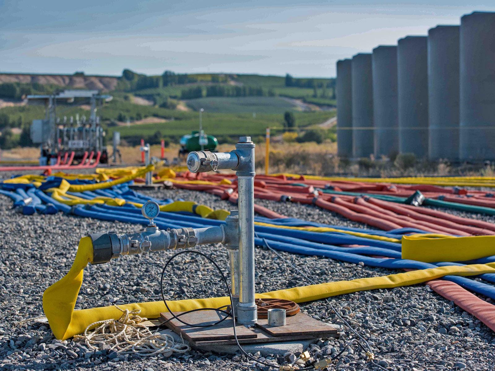
Photo of Hanford's 300 Area phosphate injection site
At Hanford’s 300 Area phosphate injection site, the colored hoses pictured above were used to inject a chemical amendment into the subsurface that binds uranium contamination to the soil. The tanks in the background contain the phosphate amendment. (Photo by Andrea Starr, PNNL.)

“I Work in Both Worlds”

In a way, Scheibe’s group is on a mission to get data that could lead to generalizable principles about groundwater dynamics and nutrient transport in the subsurface of riverine corridors.

Freedman’s group, on the other hand, is on a slow-motion rescue mission. Groundwater, and the contaminants within it, moves, on average, a foot a day―but can move as fast as hundreds of feet a day.

The two groups, however, share the two halves of PNNL’s subsurface science, sharing staff expertise, data, and knowledge transfer.

“I work in both of these worlds, both fundamental and applied” science, says Johnson, in part because of his expertise with ERT.

Historically, the subsurface mapping technology―time-lapsed imaging in real time―is used to track contaminants in the Hanford Site’s 300 Area and elsewhere. In general, researchers can’t directly see contaminants with ERT, but they can see the movement of chemical amendments used to treat contaminants.

And they can see river water moving into and out of the same aquifer. Johnson also uses ERT to track river water intrusion in and out of the inland aquifer as water levels rise and fall. Underground, he says, the flow pathways for both nutrients and contaminants near the river often follow the same pathways, like clean-powered cars merging into the same street as polluting ones powered by gasoline.

In another crossover of the basic and applied science groups, Johnson and Strickland are also developing a new riverside flux probe for Scheibe’s team.

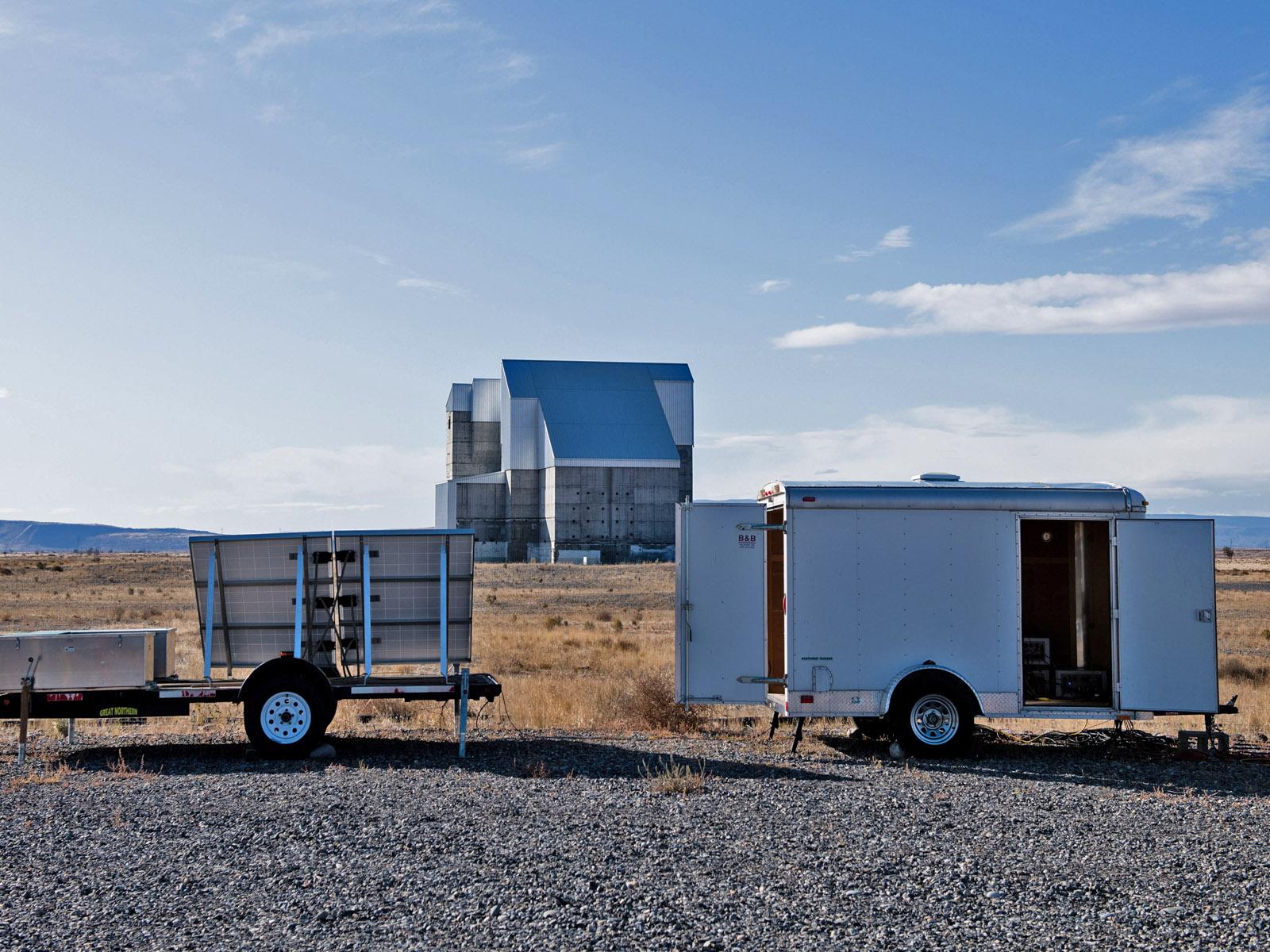
Photo of Hanford 100 Area's monitoring system
In the Hanford Site’s 100 Area, PNNL researchers installed a noninvasive monitoring system that images contaminants in the groundwater. In the background is the 100 H Reactor. (Photo by Andrea Starr, PNNL.)

Stabilizing Radionuclides

Characterizing where contaminants are located in the subsurface and quantifying contaminant behavior are where crossover collaboration commonly occurs between the basic and applied subsurface science groups.

Szecsody has a long history in developing and assisting contractors to implement remediation technologies in the field.

“You are often trying to immobilize radionuclides and metals, such as chromate, so they don’t get into the accessible environment,” he says.

Armed with this information, Mackley and PNNL environmental engineer Vince Vermeul can identify how to best inject the remediation fluids and what affect they have on contaminants.

Historical Sediment Samples

PNNL geochemist Carolyn Pearce once worked for the precursor to Scheibe’s team, but now spends most of her time working with Freedman on a range of chemical mechanisms to halt or stabilize the migration of radionuclides in groundwater.

One project, summarized in a 2018 paper, used historical bore-hole sediment samples from 49 to 219 feet below the surface to investigate technetium-99 in the deep vadose zone and to arrive at phosphate-based strategies to halt its progress underground. Pearce and colleagues, boosted by emerging analytic technologies like x-ray absorption near-edge structure spectroscopy, are now looking at ways to treat and stabilize contaminants in place, such as technetium-99 and uranium. (Technetium-99 has a half-life of 211,000 years; uranium isotopes have half-lives of up to billions of years.)

Among methods outlined in a 2020 paper led by Pearce are bismuth-based absorbents developed by PNNL scientist Tatiana Levitskaia. The idea is to precipitate out these bad actors in the deep vadose zone―before they are transported to groundwater and migrate to the Columbia River.

Photo of PNNL researcher Emily Graham
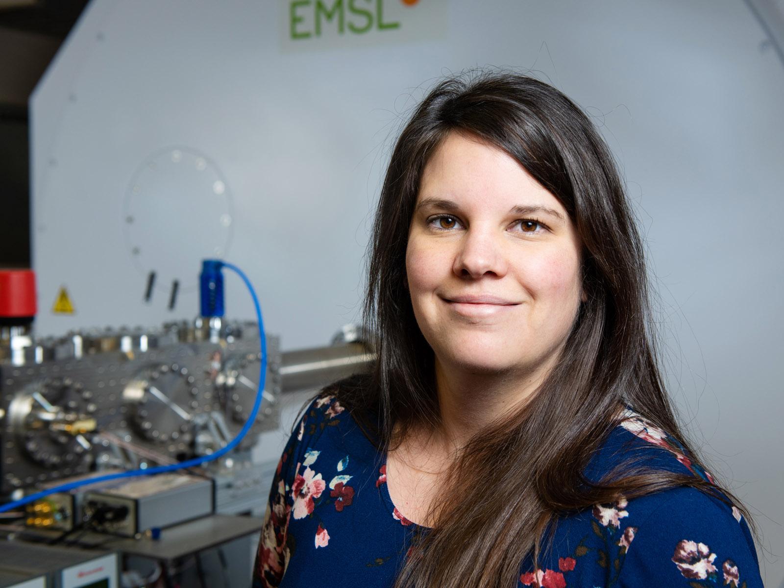
PNNL ecologist Emily Graham does work on microbial activity in the subsurface, often by using EMSL technology to probe microbiomes. (Photo by Andrea Starr, PNNL.)

Making Predictions

Along with her research on Hanford contaminants, Pearce does crossover research with Graham, the ecologist in Scheibe’s group. It’s part of research funded by the DOE’s Office of River Protection that is looking at vitrified glass used to stabilize stone walls in pre-Viking forts 15 centuries ago. The ancient glass can serve as an analog for glasses used to vitrify nuclear waste today, as outlined in a 2018 paper.

Using EMSL technology, Graham characterized biofilm remnants on the 1,500-year-surfaces to see if microbes, fungi, and other living things would stabilize or degrade vitrified waste once it is stored underground. (A follow-up paper will appear later this year.) The effect of microbiological factors on the long-term performance of vitrified radioactive waste, says Pearce, “is not something captured in the current models.”

It’s not predicted, because scientists don’t know these processes yet, so they are taking a backward look to identify how to make predictions.

Who could have predicted, either, in the era of Hanford bomb-making, that the site would become one of the most complex contaminated soil and groundwater sites in the world, requiring national laboratory expertise for successful site cleanup?

Or that the complexity of the Hanford cleanup has provided a technical forum for information sharing through RemPlex?

For that matter, who could have predicted that the Columbia River would someday have along its shores a national laboratory with complementary teams of scientists looking at how nutrients flow in the subsurface and how microbes contribute?

Johnson, the ERT expert, sees an Earth Day lesson in all of it.

“As America was becoming industrialized, we didn’t have the luxury of understanding what we were doing to the subsurface,” he says. “Now, people in countries being industrialized can learn what we’ve learned: that it’s way less expensive and much easier to not let it happen in the first place than to clean it up later.”

###

About PNNL

Pacific Northwest National Laboratory draws on its distinguishing strengths in chemistry, Earth sciences, biology and data science to advance scientific knowledge and address challenges in sustainable energy and national security. Founded in 1965, PNNL is operated by Battelle for the Department of Energy’s Office of Science, which is the single largest supporter of basic research in the physical sciences in the United States. DOE’s Office of Science is working to address some of the most pressing challenges of our time. For more information, visit https://www.energy.gov/science/. For more information on PNNL, visit PNNL's News Center. Follow us on Twitter, Facebook, LinkedIn and Instagram.