The WHONDRS Global River Image Network (GRIN) is a distributed science effort to collect river and stream shoreline photos from around the world. It began in July 2026 and is ongoing.
Participation
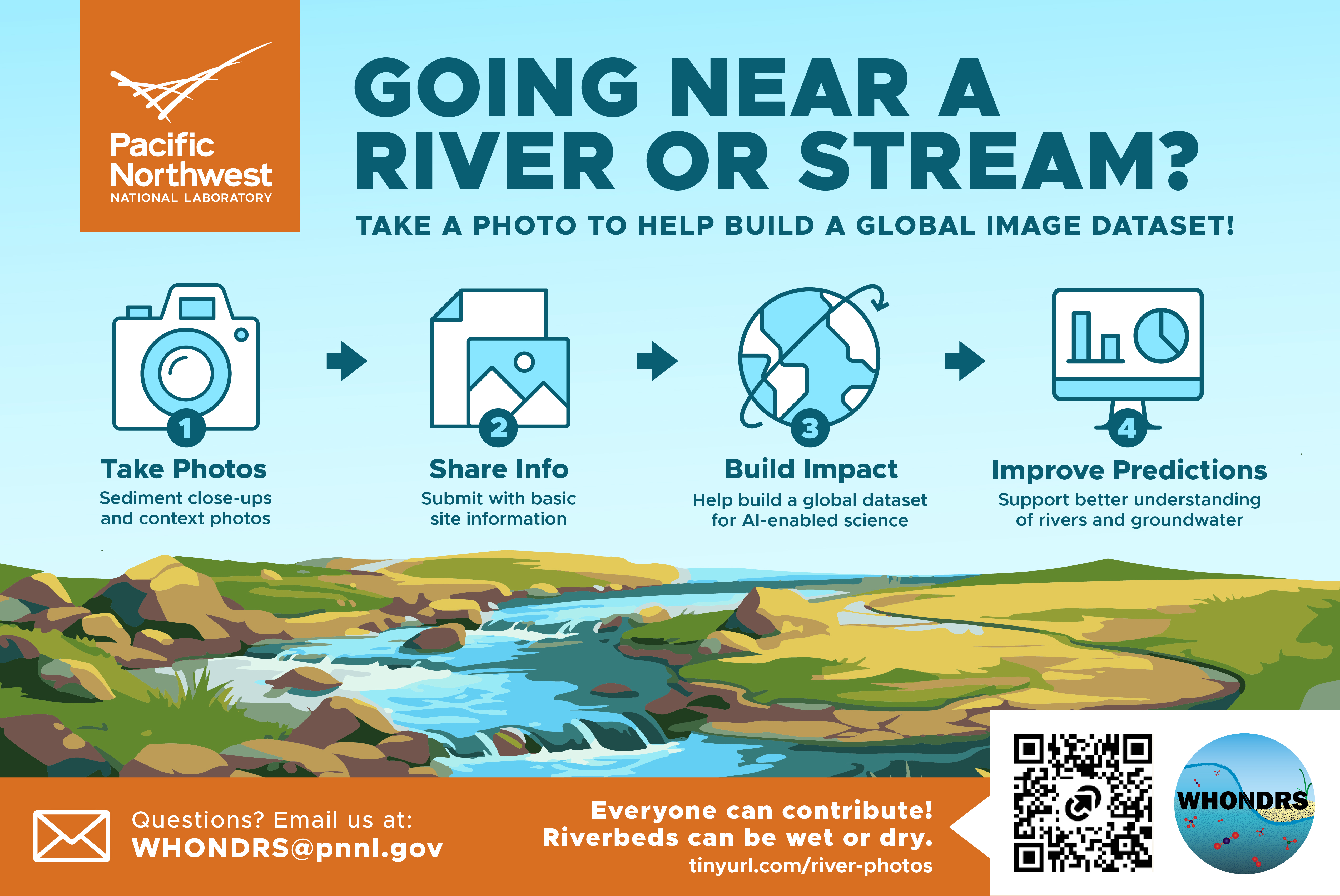
To get involved, access the protocol: https://tinyurl.com/river-photos. The protocol describes the small number of materials needed and provides guidance for taking photographs and submitting them with basic information about the site.
Anyone with access to a river can contribute, including scientists, students, educators, and members of the public. Rivers and streams of all types are welcome. They can be wet (perennial) or dry (non-perennial), small or large.
All photographs, associated site information, and derived data will be published for public use through ESS-DIVE. Contributors will be able to choose whether they would like to be listed as a coauthor on the published dataset.
Context
Modified from Regier et al. (2025)
The grain size distribution (GSD) of sediments in streams and rivers, often represented by the median of the GSD (D50) together with other percentiles of GSD, play many important roles that regulate fluvial hydrology, sediment transport and biogeochemistry, and their interactions. Grains ranging from clays to boulders control the locations and rates of groundwater-surface water exchange, which can influence stream metabolism, as well as gas (e.g., oxygen and carbon dioxide) and solute sources, fate, and transport. Because of these roles, GSD is a key metric for predicting hydraulic conductivity, flow resistance, and microbial respiration and denitrification in streambeds and for parameterizing hydromorphological models. However, constraints on accurate assessment of D50 values at the basin scale, including uncertainty and bias associated with methods used to estimate D50 and the spatially and temporally sparse nature of current D50 data, limit our ability to accurately parameterize the models used to predict key basin functions.
Outcomes
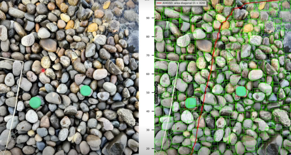
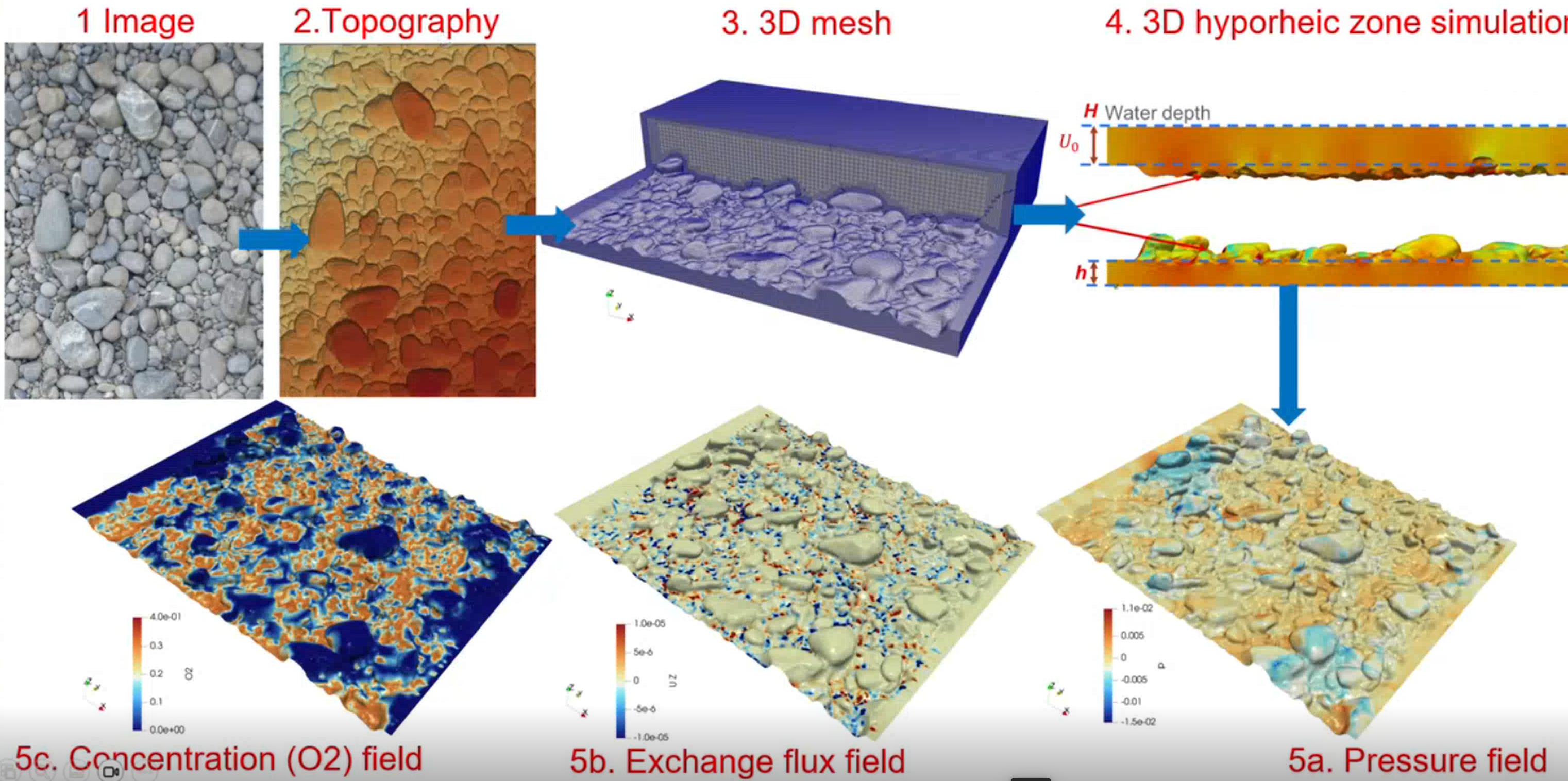
Grain size and 3D topography will be estimated from sediment photographs, which include reference objects, using AI4GSD (Fig. 1) and AI4Topography. The resulting digital elevation model (DEM) will be paired with hydrobiogeochemical information in a geometry-aware AI surrogate model, derived from DEM-driven hyporheicFoam, a surface-subsurface two-way coupled OpenFOAM simulation tool, to estimate riverbed pressure, fluxes, concentrations, and temperature (Fig. 2) supporting improved predictions of water quality and movement at river–groundwater interfaces.
Related journal articles
- Chen, Y., Bao, J., Chen, R., Li, B., Yang, Y., Renteria, L., Delgado, D., Forbes, B., Goldman, A. E., Simhan, M., Barnes, M. E., Laan, M., McKever, S., Hou, Z. J., Chen, X., Scheibe, T., and Stegen, J. C. Quantifying streambed grain size, uncertainty, and hydrobiogeochemical Parameters Using Machine Learning Model YOLO. Water Resources Research 2024, 60, DOI: 10.1029/2023wr036456.
- Regier, P., Chen., Y, Son, K., Bao, J., Forbes, B., Goldman, A. E., Kaufman, M., Rod, K. A., and Stegen, J. C. Different methods of estimating riverbed sediment grain size diverge at the basin scale. Frontiers in Earth Science 2025, 13:1529503, DOI: 10.3389/feart.2025.1529503.
Funding
Funding for this project is provided by the U.S. Department of Energy Biological and Environmental Research Environmental Systems Science (ESS) Program.