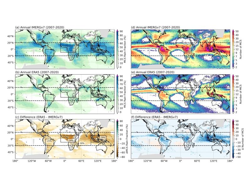
A theoretical index linking precipitation and atmospheric evaporative demand explains historical land humidity changes across observations, reanalyses, and climate models.
Observations, reanalysis, and E3SMv3 experiments linked inter-annual variability of Congo Basin surface temperature to the zonal position of precipitation over the Indo-Pacific maritime continent region.
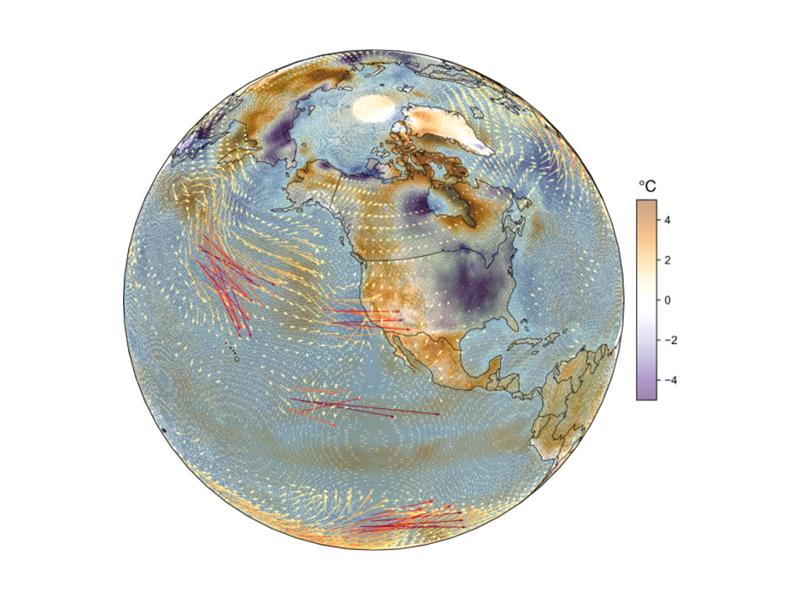
Quasi-stationary Rossby waves shape North American temperature extremes, but higher model resolution does not always improve their modeled representation.
Watershed-based representation discretized into topographic subgrid units better captured small-scale land cover, precipitation, temperature, and snow variability across multiple spatial scales.
Numerical simulations reveal how well-controlled wall temperature and moisture can generate a stratocumulus-like cloud top in a laboratory cloud chamber.
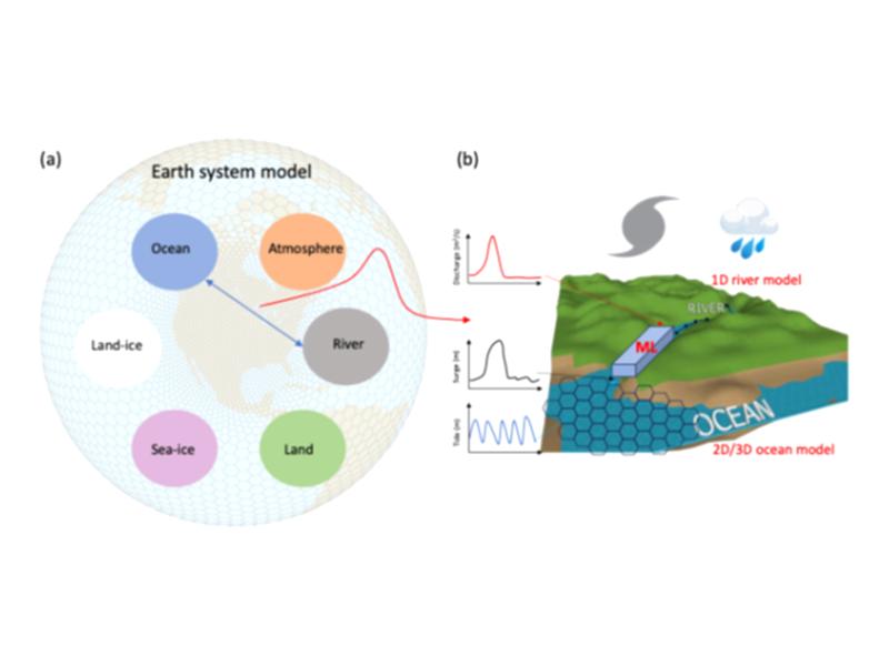
Tracking water age using a new precipitation tagging method within a hydrologic model generates key information to support hydropower energy and other water-dependent systems.
A team from PNNL joined the Department of Homeland Security Science and Technology Directorate and first responders from across the country to evaluate commercially available unmanned ground vehicles for emergency response.
PNNL has administered NGFP on behalf of NNSA since 2002. Looking toward the future, NGFP has signed a partnership agreement with INMM with the goal of expanding its reach to more future leaders with a passion to serve.
PNNL has developed a next-generation electrical resistivity tomography system for DOE that uses E4D software and AI-enhanced modeling to produce real-time subsurface images that help guide environmental remediation decisions.