Researchers at PNNL have developed an interpretable, lightweight AI model that can easily predict weld microstructure features using only basic machine sensor inputs.
PNNL has developed a next-generation electrical resistivity tomography system for DOE that uses E4D software and AI-enhanced modeling to produce real-time subsurface images that help guide environmental remediation decisions.
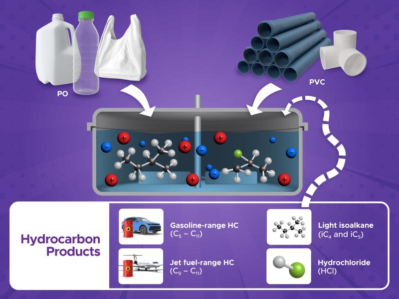
Replacing commercial acid with acidic waste enables researchers to improve nickel extraction efficiency, lower projected costs, and improve process economics.
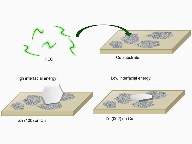
Researchers discovered that a polymer additive promotes smooth, layer-by-layer deposition on metal electrodes by tuning interactions with the substrate.
Matteo Muratori, director of transportation and industry programs at PNNL, has been named to the 2026–2028 cohort of the National Academies of Sciences, Engineering, and Medicine’s New Voices Program.
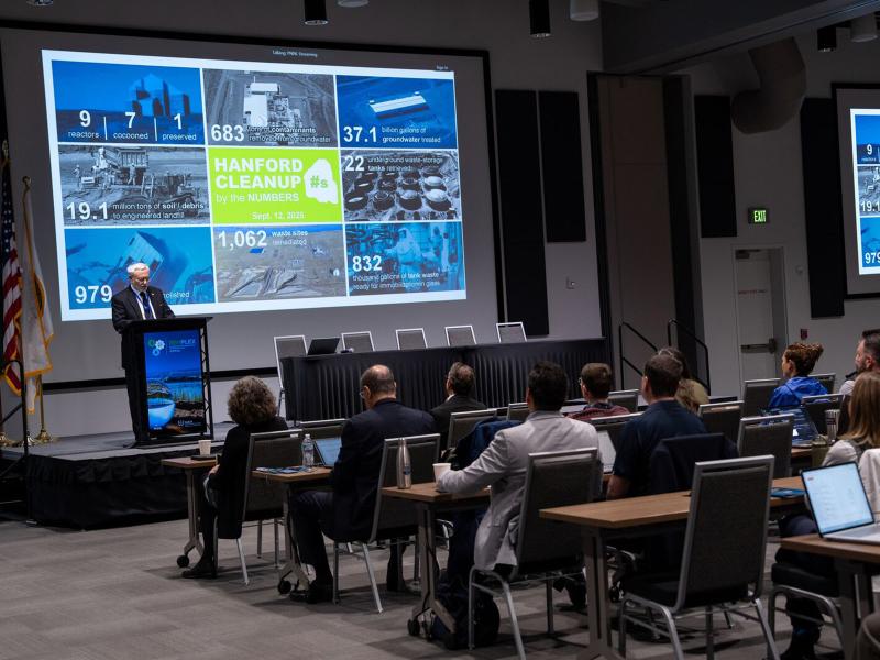
RemPlex 2025 Global Summit on Environmental Remediation attendees share knowledge about cleanup and monitoring of complex sites worldwide; more than 100 presentations are posted online.
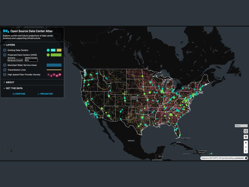
Now, anyone can easily explore and access data from a nationwide map of data centers, the infrastructure that powers them, and projections of future data center locations.
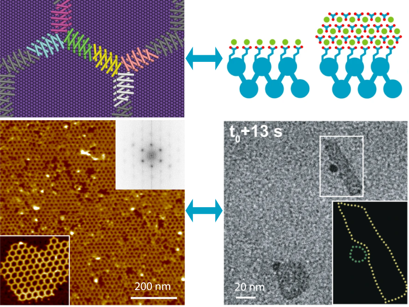
Summarizing the state of designed protein hybrid materials, researchers celebrate both the 50th anniversary of the MRS Bulletin and the 2025 Fred Kavli Distinguished Lecturers in Materials Science, Jim De Yoreo and David Baker.
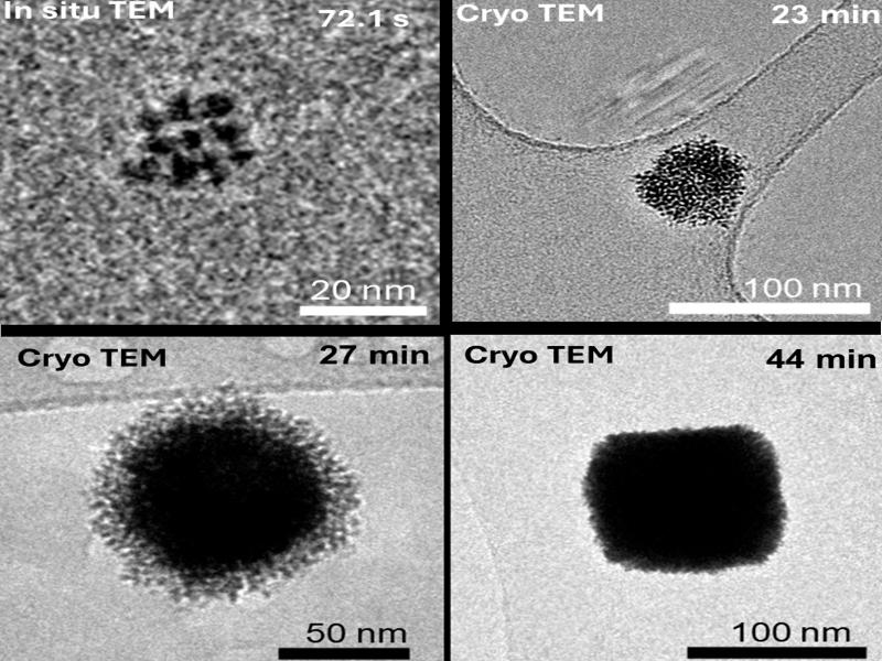
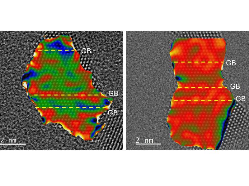
Hydrogen preferentially inserts at grain boundaries between interconnected chains of palladium nanoparticles, which have a lower energy barrier for hydrogen incorporation into the material.
From developing new energy storage materials to revealing patterns of Earth’s complex systems, studies led by PNNL researchers are recognized for their innovation and influence.
Distributed science is thriving at PNNL, where scientists share data and collaborate with researchers around the world to increase the impact of the work.
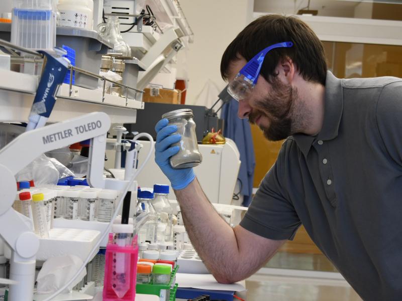
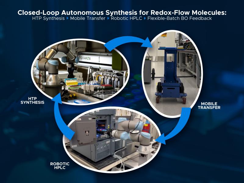
A closed-loop workflow brings together digital and physical frameworks to advance high-throughput experimentation on redox-active molecules in flow batteries.