Innovative cement and concrete technologies at PNNL enhance durability and performance through self-healing formulations and cost-effective, high-performance materials derived from waste, enabling more resilient, reliable infrastructure.
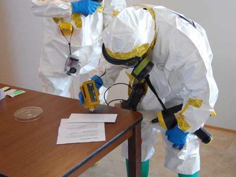
PNNL partners with the Department of Homeland Security, industry, and the first-responder community to improve the effectiveness and safety during biodetection responses.
RemPlex provides a global forum committed to fostering technical leadership, collaborative research, and professional development that facilitates the cost-effective remediation of complex sites.
E4D is a 3D geophysical modeling and inversion program designed for subsurface imaging and monitoring using static and time-lapse electrical resistivity tomography (ERT), spectral induced polarization (SIP) and travel-time tomography data.
PNNL’s integrated software systems (FRAMES, MEPAS, MetView, APGEMS, CAPP) allow users to assess the environmental fate and transport of contaminants—and the potential impacts on humans and the environment—in a systematic, holistic approach.
From global issues such as melting permafrost and the creation of alternate biofuels to matters affecting microbiomes and micro-sized life, PNNL research is featured in news publications worldwide.
PNNL is a leader in the integration of aberration-corrected electron microscopy, in-situ techniques, and atom probe tomography to address challenges in nuclear materials, environmental remediation, energy storage, and national security.
GeoBOSS is a software library that combines the data-handling capabilities of Spark and the user-friendliness of Python to simplify geospatial analytics and the transition between small-scale research and large-scale operational projects.
The Ion Dynamics in Radioactive Environments and Materials (IDREAM) Energy Frontier Research Center (EFRC) conducts fundamental science to support innovations in retrieving and processing high-level radioactive waste.
IrrigationViz is a visual decision-support tool that provides users with high-level estimates for irrigation modernization projects, such as concrete lining for a canal or replacing a canal with a pipeline.
The user-friendly Project Schedule Visualizer software developed at PNNL helps users readily identify and understand the impacts of updates to the schedule, budget, and risks associated with large, complex projects that cross departments.
RadAnalysis is a software developed by the Department of Energy to assist in the packaging and transportation of radioactive materials. It facilitates compliance with regulations, providing consistency, accuracy, and relevant documentation.
PNNL combines AI and cloud computing with damage assessment tools to predict the path of wildfires and quickly evaluate the impact of natural disasters, giving first responders an upper hand.