Innovative cement and concrete technologies at PNNL enhance durability and performance through self-healing formulations and cost-effective, high-performance materials derived from waste, enabling more resilient, reliable infrastructure.
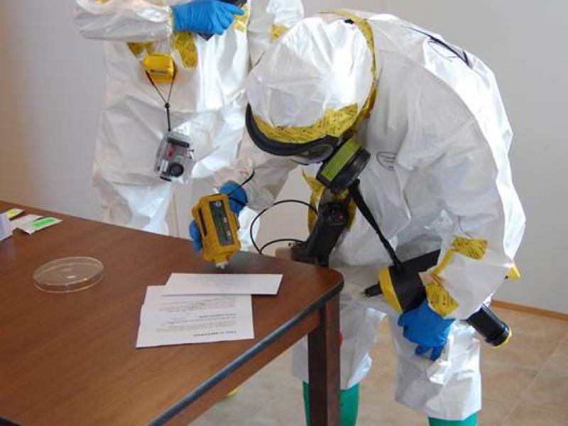
PNNL partners with the Department of Homeland Security, industry, and the first-responder community to improve the effectiveness and safety during biodetection responses.
The Community Earth atmospheric Data System (CEDS) provides historical surface flux data that are used for general analysis and also for model validation through comparisons with observations.
RemPlex provides a global forum committed to fostering technical leadership, collaborative research, and professional development that facilitates the cost-effective remediation of complex sites.
The Center for Understanding Subsurface Signals and Permeability (CUSSP) Energy Earthshot Research Center (EERC) is working to develop the ability to predict and control fluid flow through fracture networks in enhanced geothermal systems.
The Computational and Theoretical Chemistry Institute (CTCI) aspires to establish a premier international center for chemistry and materials science software at extreme scales.
A multi-institution research team led by PNNL is addressing curb usage management challenges in large urban areas by developing a city-scale dynamic curb use simulation tool and an open-source curb management platform.