Intersection 2
PNNL is revolutionizing applied research capabilities at the field-scale for new data processing workflows that assimilate subsurface remote sensing data into modeling frameworks. The integration of remote-sensing, data-driven modeling, and autonomous updating of subsurface models enables simulators to estimate or “learn” the critical parameters that control subsurface behavior and improve predictions of subsurface processes. It also provides the comprehensive feedback mechanism necessary for unprecedented new capabilities in subsurface control and optimization. In doing so, PNNL will achieve a revolutionary level of autonomous, comprehensive, integrated subsurface model-data integration to supply enhanced subsurface understanding—to the benefit of every stakeholder with interest in the subsurface. This advancement is made possible by enabling remote subsurface sensing data to directly inform massively parallel predictive simulators.
Intersection 2 Highlight
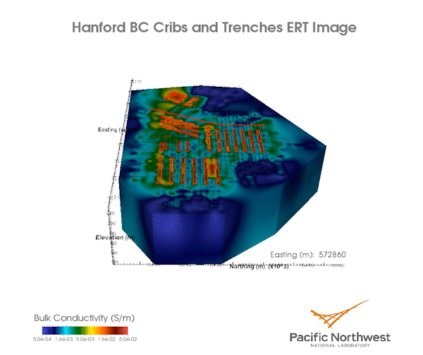
Simulating current distribution of contamination, predicting future migration
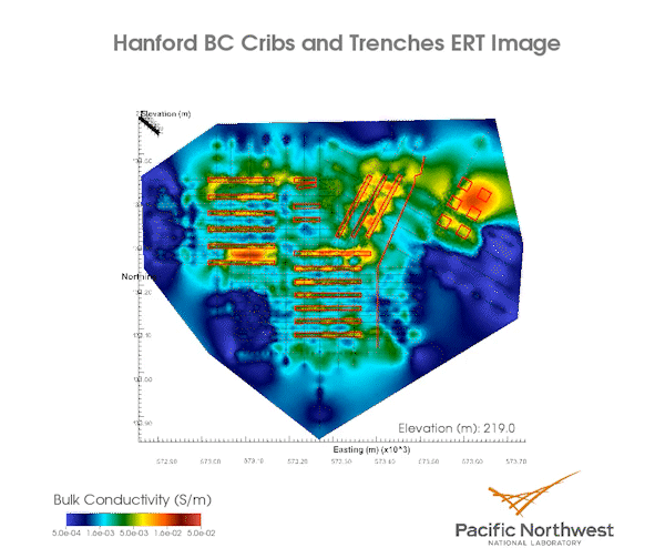
beneath the Hanford Site BC-Cribs and Trenches. (Pacific Northwest National Laboratory)
PNNL developed a new capability to ingest a massive time-lapse surface electrical resistivity tomography (ERT) data set collected over the Hanford BC-Cribs and Trenches site. This site holds the largest inventory of technetium-contaminated soil in the Department of Energy (DOE) complex. Conceptually, the ERT data remotely senses the downward migration of the contaminant plume through the vadose zone at two points in time separated by 15 years.
Next, a parallel multi-physics flow and transport simulator (PFLOTRAN) is used to directly assimilate the ERT data and estimate the soil parameters that govern contaminant migration. These soil parameters are required to accurately simulate the current distribution of contamination and to predict future contaminant migration under a given scenario (changes in precipitation rates due to climate change, remediation operations, etc.). It also provides the DOE Richland Operations Office and site contractors with an unprecedented capability to understand, predict, and manage contaminant flow to the water table, reducing the costs to mitigate uncertainty and enhancing protection of human health and the environment.
beneath the Hanford Site BC-Cribs and Trenches. (Pacific Northwest National Laboratory)