From Cargo Route to Atmospheric Observatory
A Pasha Hawaii container ship’s regular San Diego-to-Honolulu run is becoming a long-term platform for collecting atmospheric data over the Pacific

The Pasha Hawaii cargo ship M/V Marjorie C travels regularly between San Diego and Honolulu, carrying the autonomous BEACONS observing platform. Its repeated route allows scientists to build a long-term record of atmospheric conditions over the Pacific Ocean.
(Photo by Raghavendra Krishnamurthy | Pacific Northwest National Laboratory)
As the ship M/V Marjorie C crosses the Pacific Ocean between San Diego and Honolulu, it delivers a stream of data in the form of atmospheric measurements to shore. Every 10 minutes, aerosol and cloud properties and atmospheric and surface weather conditions are all recorded and streamed to satellites above. No research crew is available for onboard maintenance of the equipment. The scientific instruments and their platform are on a commercial container ship carrying cargo on its regular route.
The partnership between a commercial vessel and a suite of research instruments is the foundation of the partnerships behind the Boundary Layer Exploration of Aerosols and Clouds ON Ships (BEACONS) project. On July 1, 2026, BEACONS officially deployed an autonomous observing platform aboard the M/V Marjorie C, operated by Pasha Hawaii. Built by Pacific Northwest National Laboratory researchers and collaborators, the system measures the atmosphere in a variety of ways over stretches of ocean that traditional research campaigns rarely reach. The 2026 deployment moves BEACONS out of the lab from prototype testing and onto a long-term observatory onboard a commercial ship along its planned route.
From bench to bridge
Of the 70 percent of the planet covered by ocean, much of it remains vastly unobserved. Marine aerosol and cloud measurements help scientists understand how the atmosphere behaves in this expanse. Historically, many of those measurements have come from short, expensive research cruises staffed by scientists and technicians.
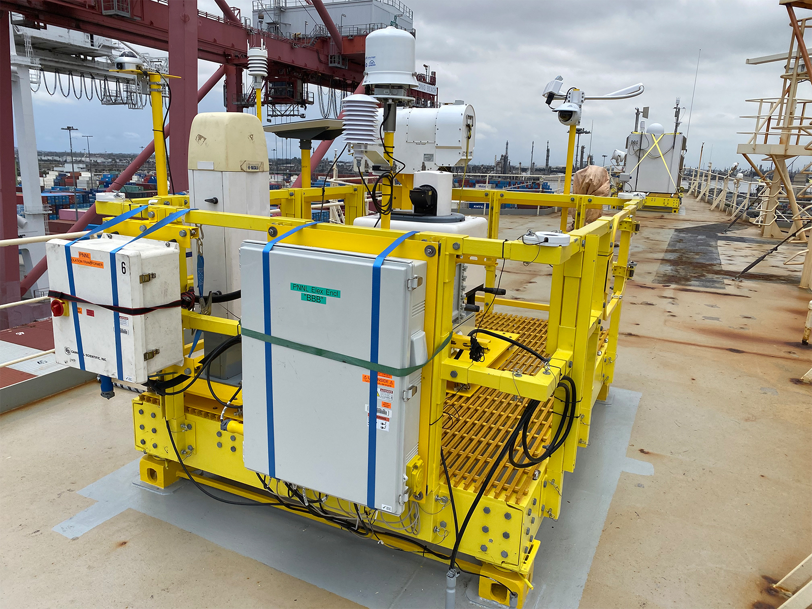
BEACONS takes a different approach: put automated instruments on a ship and on a route that repeats. Pasha Hawaii provides a space on the top of the bridge, power, and access to a fixed, roughly two-week round trip between California and Hawaii. Each time the route repeats, the project gets another opportunity to observe the atmosphere along the same corridor.
Pacific Northwest National Laboratory leads the science and engineering, working alongside partners including the University of Washington Cooperative Institute for Climate, Ocean, and Ecosystem Studies, the National Oceanic and Atmospheric Administration’s Pacific Marine Environmental Laboratory (NOAA PMEL), and other unfunded partners with expertise in remote sensing, forecasting, and autonomous systems. For Pasha Hawaii, the partnership is an opportunity to support the research while sharing operational knowledge about the ship and route.
“It is a privilege to support research on a route well suited to BEACONS,” said Mats Holmqvist, Technical Superintendent with Pasha Hawaii. “The data they receive will contribute to greater knowledge of maritime operations, and the information they learn from our operations will further enhance their understanding of how the ships operate.”
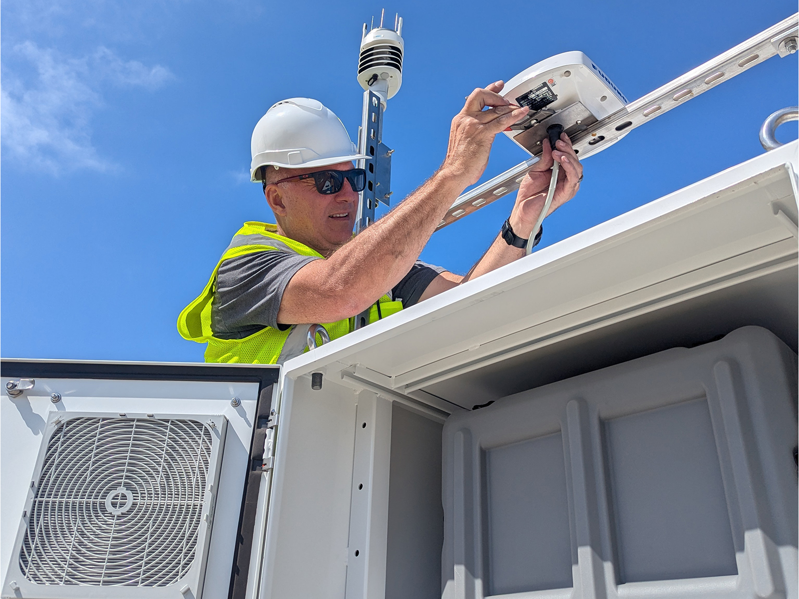
Making that collaborative model work requires more than putting laboratory instruments on deck. Equipment designed for careful, hands-on operation has to withstand months of salt spray, vibration, rough seas, and little or no direct attention. BEACONS is addressing that challenge in phases. Phase one deployed essential instruments proven in earlier campaigns. Phase two will add instruments that need more adaptation for marine conditions. Phase three, enabled by a two-year funding extension, will add new low-cost sensors and AI tools to advance the observations and help make sense of the data the platform collects.
Always on when at sea
BEACONS is not simply a collection of instruments placed on a ship. It is an autonomous observing platform engineered to keep operating when no scientist is on deck. Its modular design allows new and different instruments to be swapped in to tackle more advanced research questions.
The team developed marine-hardening techniques to maintain the quality of the observations and reduce the effects of the harsh marine environment on the equipment. When salt spray collects on the Doppler lidar lens, the platform can detect the problem and clean the lens automatically in a process the team calls the “sneeze system.” The system sprays the lens, then photographs it before and after to confirm the cleaning worked. Motion-compensation algorithms correct for the ship’s roll and pitch so the lidar, radiometer, and surface weather sensors can keep collecting usable data even in rough seas.
Tasks that would normally require someone on deck, including power cycling, software updates, and calibration checks, can be handled remotely, with real-time monitoring from shore watching over the system.
“We had to dramatically reduce the aerosol instrument footprint, automate real-time data collection, and deploy and service the platforms during brief port calls,” said Derek Coffman of NOAA PMEL.
“Overcoming these hurdles has enabled repeated aerosol measurements across the Eastern Pacific in a way never before possible,” said Tim Bates of the University of Washington.
From the sea to your screen
The measurements are available on a public website as downloadable raw, preliminary post-processed data and plots. Final post-processing is still being developed, but the raw feed is already flowing.
The reach of those observations extends beyond BEACONS’s own science questions. The data is expected to feed into the Global Telecommunication System, where forecasting models can use the observations to help initialize forecasts. The observations can support research on aerosol–cloud interactions, satellite calibration, and improved forecasting of weather relevant to the shipping industry, i.e., marine fog. The team also plans to use AI-based tools to automatically characterize incoming data in real time.
As the project grows, the same approach could be applied to other ships and routes, creating opportunities to collect data autonomously across other regions of the Pacific and beyond.
Building the record, voyage by voyage
Since deployment began July 1, every round trip the Marjorie C completes has added data from a part of the Pacific that has rarely been measured this consistently or for this long. The current campaign runs through September 2028. The project expects to collect more than 120 weekly observational transects between San Diego and Honolulu. By observing the same route across seasons and changing weather patterns, researchers can study how the marine atmosphere evolves over short and long timescales and investigate its influence on weather systems over the continental United States.
“This project brings together the collective experience of industry, universities, and Department of Energy national labs to tackle an important national security challenge and advance state-of-the-art autonomous observations at a scale and under conditions not previously attempted,” said Raghavendra (Raghu) Krishnamurthy, lead principal investigator for BEACONS.
If the approach works as the team hopes, BEACONS will do more than fill a gap in atmospheric observations. It will offer a working example of how a national laboratory, federal partners, universities, and a commercial shipping company can turn an ordinary cargo route into ongoing scientific infrastructure.
Curious what BEACONS is observing right now? Visit the BEACONS project website to learn more about the platform and follow the live data feed as aerosol and cloud observations arrive from the Pacific in near real time: https://beacons.labworks.org/. If you have any questions or would like to be more involved, please sign up for the newsletter by sending an email to beacons@pnnl.gov.
The outline of this story was produced with generative artificial intelligence (OpenAI ChatGPT-5.6) from meeting notes and source material. It was subsequently written, reviewed, and refined by humans.
Published: October 19, 2026