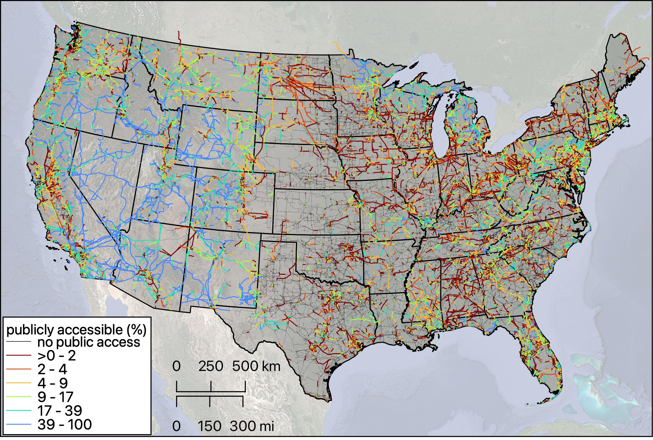
Transmission lines often intersect with publicly accessible areas, raising new opportunities for co-utilizing this space. Public access areas are typically owned or managed by government entities and can be used for a variety of recreational, educational, and cultural activities. The Protected Areas Database of the United States (PAD-US) 3.0 dataset developed by the U.S. Geological Survey provides a geospatial inventory of U.S. public lands as well as easements and leases, predominantly areas managed by the government. For example, PAD-US includes county parks in Pennsylvania, national parks in California, and Army installations in Georgia. Here, striving to only consider areas that are publicly accessible, we are analyzing just public areas by filtering the PAD-US3.0 when “Pub_Access = ‘open’ ”, excluding ‘restricted’, ‘closed’, or ‘unknown’ designated areas.
The percent of these lines lengths that is publicly accessible is highest in the West, contrasting with no accessible areas in the U.S. Midwest, and then being spatially complex in the East.
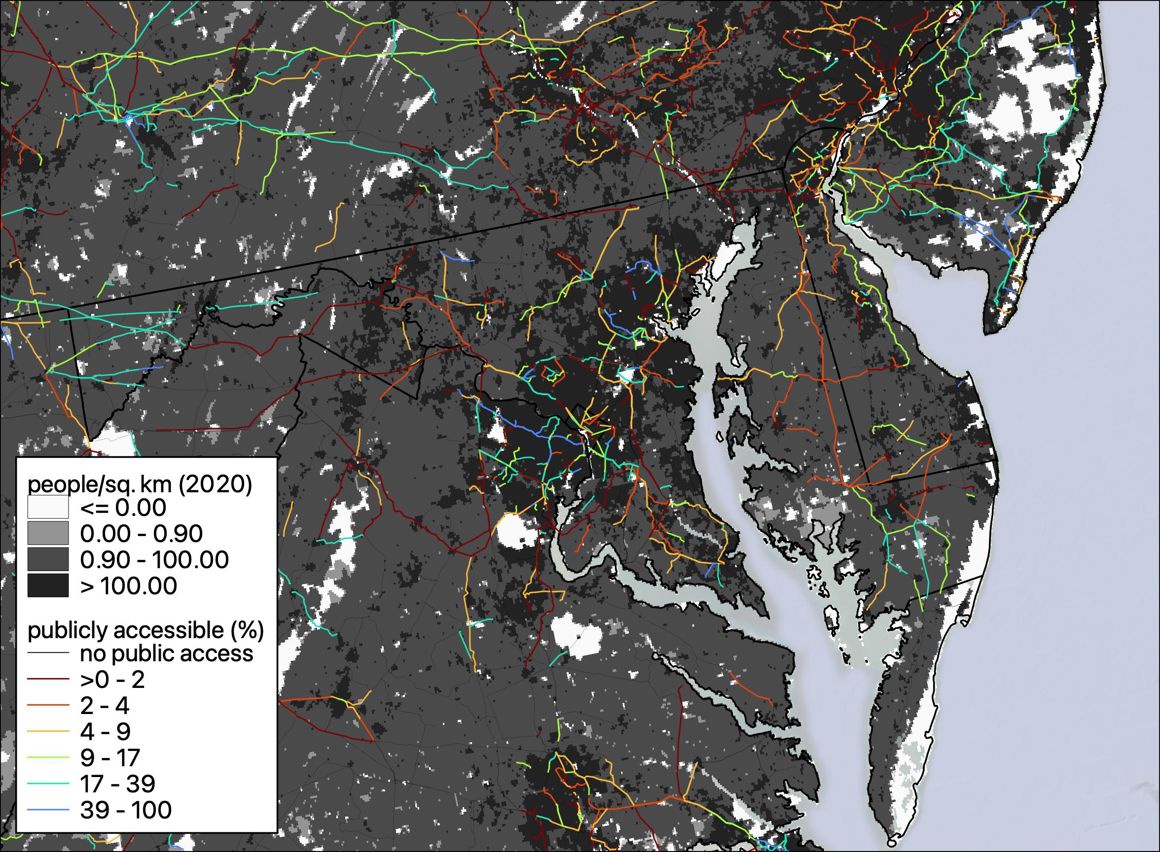
Public Access Sections of Transmission Lines in Washington D.C.
PNNL-SA-210071