RemPlex provides a global forum committed to fostering technical leadership, collaborative research, and professional development that facilitates the cost-effective remediation of complex sites.
Pacific Northwest National Laboratory, supported by the Department of Energy’s Grid Deployment Office, is leading a technical assistance initiative to help utilities test and deploy alternate GPS timing solutions.
E4D is a 3D geophysical modeling and inversion program designed for subsurface imaging and monitoring using static and time-lapse electrical resistivity tomography (ERT), spectral induced polarization (SIP) and travel-time tomography data.
PNNL’s integrated software systems (FRAMES, MEPAS, MetView, APGEMS, CAPP) allow users to assess the environmental fate and transport of contaminants—and the potential impacts on humans and the environment—in a systematic, holistic approach.
From global issues such as melting permafrost and the creation of alternate biofuels to matters affecting microbiomes and micro-sized life, PNNL research is featured in news publications worldwide.
PNNL is a leader in the integration of aberration-corrected electron microscopy, in-situ techniques, and atom probe tomography to address challenges in nuclear materials, environmental remediation, energy storage, and national security.
The Grid Storage Launchpad (GSL) is a national capability for energy storage research funded by the Department of Energy Office of Electricity and located on the Pacific Northwest National Laboratory (PNNL) campus in Richland, Washington
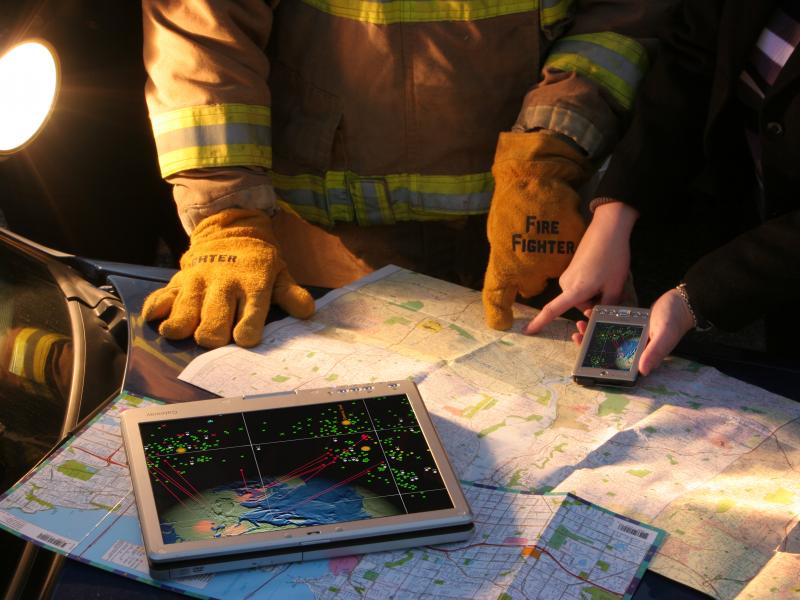
The National Response Framework Policy Landscape Analysis Tool interactively captures and visualizes intricacies of the National Response Framework, a federal guide to national response to all types of disasters and emergencies.
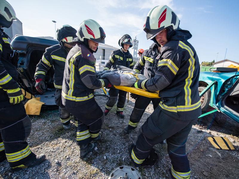
PNNL combines AI and cloud computing with damage assessment tools to predict the path of wildfires and quickly evaluate the impact of natural disasters, giving first responders an upper hand.
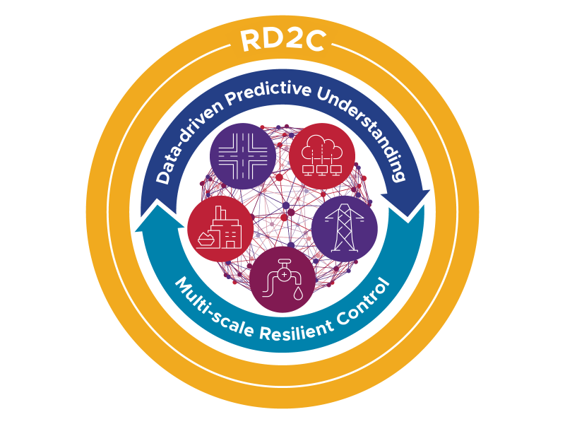
The RD2C laboratory-directed research initiative seeks to develop resilient, adaptive, and intelligent sensing and control algorithms through the observational understanding and characterization of CPSs under adverse conditions.
PNNL has developed performance assessment guidance for remediation of volatile contaminants in the vadose zone, inorganic contaminant remediation in the vadose zone, and pump-and-treat of groundwater contaminant plumes.
The Salish Sea Model (SSM) is a predictive coastal ocean model for estuarine research, restoration planning, water-quality management, and climate change response assessment.