PNNL partnered with the Treasury and AWS to develop Cache, a cloud-based tool that allows the Treasury’s disparate data to be easily searched, translated, extracted, linked, and analyzed.
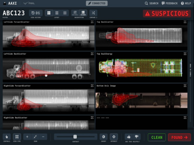
The CVAir pilot project transports computed tomography passenger baggage data from originating international airports for targeted flights destined for the U.S.
A multi-institution research team led by PNNL is addressing curb usage management challenges in large urban areas by developing a city-scale dynamic curb use simulation tool and an open-source curb management platform.
PNNL partners with agencies and industry to identify and engage historically disadvantaged populations in regulatory decision-making, environmental assessment, and impact estimation of the consequences of complex polices and projects.
GeoBOSS is a software library that combines the data-handling capabilities of Spark and the user-friendliness of Python to simplify geospatial analytics and the transition between small-scale research and large-scale operational projects.
The National Response Framework Policy Landscape Analysis Tool interactively captures and visualizes intricacies of the National Response Framework, a federal guide to national response to all types of disasters and emergencies.
PREPARES demonstrates linkages between climate or weather conditions and human domain systems by combining quantitative geophysical data with qualitative data.
PNNL combines AI and cloud computing with damage assessment tools to predict the path of wildfires and quickly evaluate the impact of natural disasters, giving first responders an upper hand.
Powered by few-shot learning, the Sharkzor AI-driven, scalable web application makes it possible to quickly characterize and sort electron microscopy images used to analyze radioactive materials.