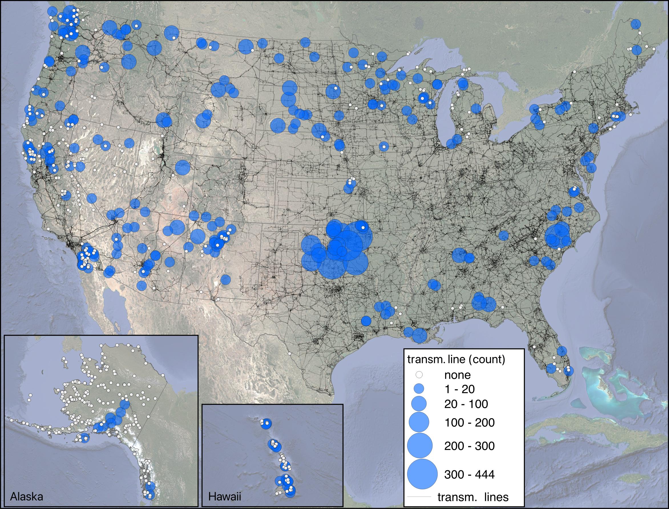
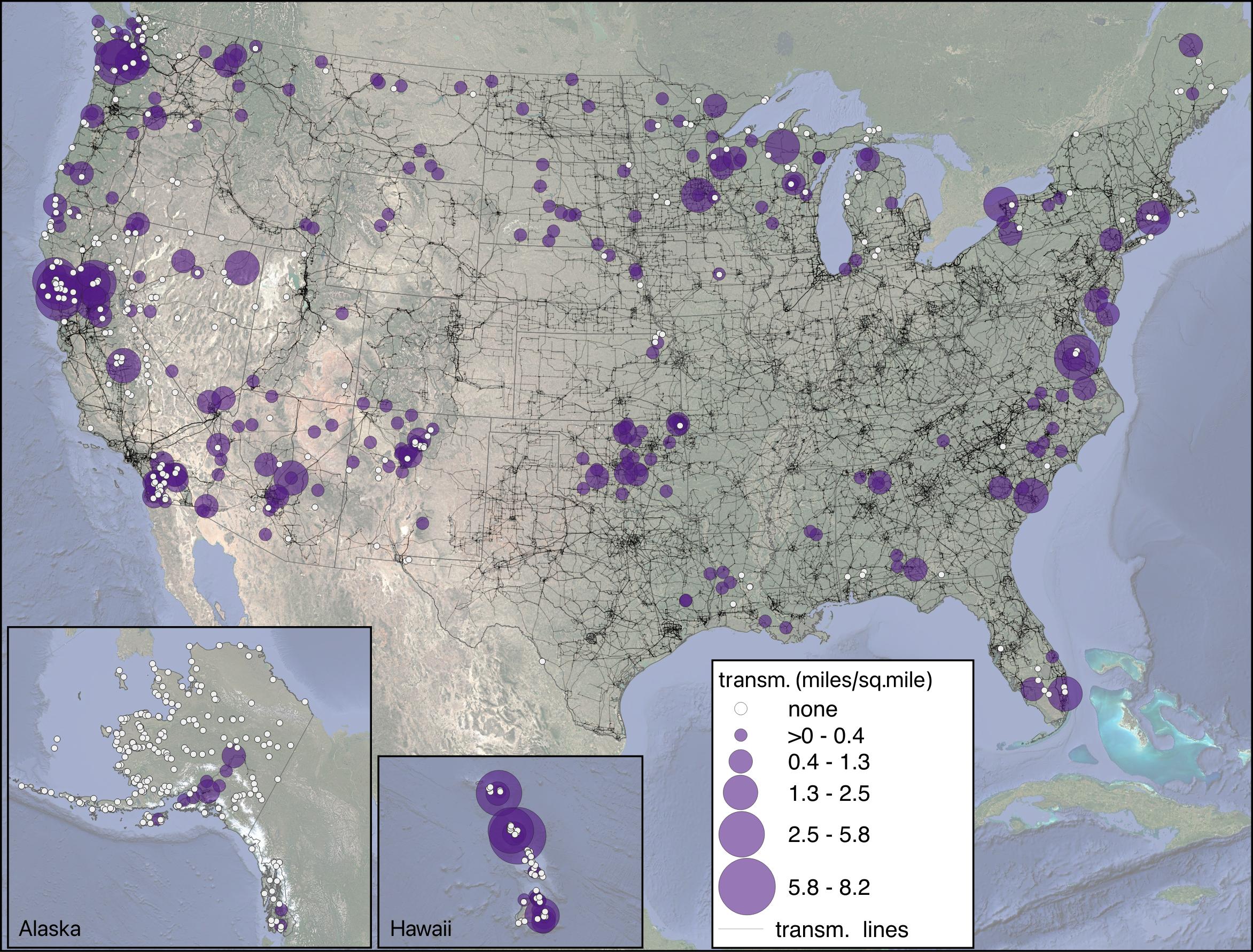
The top map shows the number of transmission lines intersecting each tribal area, while the bottom map highlights the density of those lines—measured in miles per square mile. Policymakers, tribal governments, and developers can use this information to identify where infrastructure investments could support tribal energy sovereignty, economic development, or grid resilience, while also ensuring tribes are meaningfully consulted in planning processes. These maps support efforts to build partnerships and prioritize co-benefits when planning new transmission projects.