PNNL Researchers Using AI to Aid Disaster Response and Recovery

Image by ThePixelman | Pixabay.com
For some, all the talk about artificial intelligence sounds like science fiction, where futuristic societies are overrun by robots that begin to think for themselves. And given all the hype about AI, it is not surprising that 61 percent of respondents in a recent Reuters poll believed that AI poses risks to humanity.
While there are legitimate concerns about the development and use of AI, it also offers great benefits. At the Department of Energy’s Pacific Northwest National Laboratory, researchers are advancing AI and exploring its ability to accelerate scientific discovery, deepen understanding of complex issues and improve operations and emergency response.
For example, PNNL researchers are using AI techniques to predict and plan for emergencies, such as wildfires and hurricanes, as well as to help respond and recover from them as quickly as possible.
With funding from government sponsors, researchers at PNNL developed a software tool called RADR (short for Rapid Analytics for Disaster Response) to provide situational awareness and damage assessments within hours of a natural disaster or other emergency. RADR combines image-capturing technology, artificial intelligence and cloud computing to assess damage and predict risks.
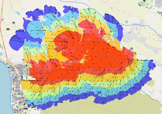
RADR does this by ingesting and analyzing overhead imagery and other data captured by drones, planes and various government and commercial satellites. Some of this data includes infrared and radar-based imagery that provides a clearer view of landscapes obscured by smoke or clouds. The team also is researching the addition of crowd-sourced information such as social media feeds.
So how does AI help? Mathematical algorithms automatically extract information from these high-resolution images to quickly create and disseminate detailed hazard maps over a large geographic area. By stitching together available imagery collected during an event, RADR can assess specific damage to power lines, transmission towers, generation facilities and other energy infrastructure. With this information at their fingertips, responders can rapidly make decisions about where and how to act.
RADR originally was developed for natural disasters, such as hurricanes, floods and wildfires, that can damage the energy infrastructure. It has been used in hundreds of events to assist first responders, emergency support functions, energy providers, and state and local governments. For example, it has been used to assess flooding damage to utility assets in the aftermath of several hurricanes. It also was used in June to analyze flooding after Ukraine’s Kakhovka Dam was breached. And most recently, RADR was deployed to aid response and recovery efforts during and after the tragic Maui wildfires.
Specific to wildfires, the PNNL team is working to incorporate other kinds of data to expand the tool’s utility from observation and response to prediction and prevention. This version, called RADR-Fire, uses various overhead imagery to gather up-to-date information about vegetation and landscape conditions, helping improve predictions of wildfire risk and possible spread. Combining this with forecasted meteorology and past fire behavior data, RADR-Fire can better identify potential risks to communities and infrastructure.
RADR-Fire is being used in the Northwest to identify pre-season and seasonal wildfire risk. This knowledge can inform a variety of wildfire mitigation and prevention efforts such as vegetation management and equipment replacement.
RADR is just one example of how PNNL researchers are using the power of artificial intelligence to serve humankind. This is very much in line with a recent quote from Apple’s CEO, Tim Cook, who said, we must “...make sure we are using AI in a way that is for the benefit of humanity, not to the detriment of humanity.” And as AI continues to develop and be used in new ways, you can count on the experts at PNNL to abide by this advice.
Steven Ashby, director of Pacific Northwest National Laboratory, writes this column monthly. To read previous Director's Columns, please visit our Director's Column Archive.
Published: September 25, 2023