September 29, 2022
Research Highlight

Identifying Green Vegetation Variability over the Southern Great Plains

A new method to identify the fraction of green vegetation from satellite data at high spatial resolution

Photograph looking down at vegetation from an airplane window

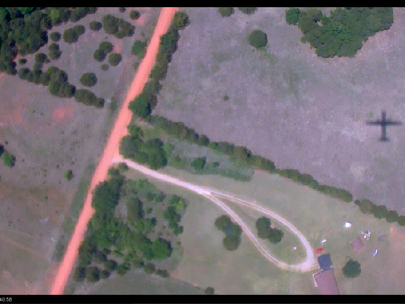
Conventional medium-resolution satellite observations miss the fine-scale variability shown in this image, biasing green vegetation fraction estimates.

(Image: Atmospheric Radiation Measurement Aerial Facility [G-1 Aircraft])

The Science                                 

Large uncertainties persist in simulations of near-ground meteorological properties made using weather forecasting models associated with specifying surface properties, including the plant canopy. Scientists frequently derive details of the plant canopy for numerical weather-prediction models using the Moderate Resolution Imaging Spectroradiometer (MODIS) satellite. MODIS’s 500-meter resolution cannot resolve fine-scale detail in vegetation cover, such as variability across a field or changes in vegetation near a river. To fill the gap, researchers developed an approach to retrieve the green vegetation fraction (GVF) using Sentinel-2 satellite data at 10 m resolution. They compared their results to available coarser-resolution platforms including MODIS, Sentinel-3, and the Department of Energy’s Atmospheric Radiation Measurement (ARM) user facility Aerial Facility observations.

The Impact

Surface properties that play critical role in determining how much of the sun’s energy is absorbed at the surface and how much is reflected to the atmosphere, like albedo, depend on many factors. GVF is one factor needed to accurately simulate albedo and how energy partitions into fluxes of heat and moisture. The newly developed approach to estimating GVF has the potential to represent surface properties more realistically and to contribute to the development of land-surface parameterizations in numerical weather-prediction models.

Summary

GVF at a high spatial resolution (10 m) is retrieved by applying a new method based on image analysis using multiple spectral bands from the Sentinel-2 satellite. The method uses true color and multispectral images at 10 m resolution over a 2,500 km2 domain to recognize green pixels and estimate the vegetation fraction. The domain centers on the ARM user facility’s Southern Great Plains site. The method compares the GVF retrieved from several spectral bands with Sentinel-2 true color images, Sentinel-3, and MODIS vegetation products, and ARM Aerial Facility observations from the Holistic Interactions of Shallow Clouds, Aerosols, and Land-Ecosystems (HI-SCALE) campaign. This new method is independent of absolute reflectance and the photosynthetic response, unlike MODIS and Sentinal-3 approaches. All three satellite retrievals show similar spatial patterns in vegetation distribution, but MODIS underestimates the vegetation cover by about 10% compared to the Sentinel-2 and -3 retrievals. The Sentinel-2-based analysis shows large spatial variability in GVF and a clear disparity with estimates from MODIS and Sentinel-3 satellites. The new approach to estimating GVF can potentially increase the spatial accuracy of surface properties relevant for crop and forest management, energy-balance and surface processes, and land-surface parameterizations in atmospheric models.

PNNL Contact

Jerome Fast, Pacific Northwest National Laboratory, jerome.fast@pnnl.gov

Funding

This research was supported by the Atmospheric Science Research program as part of the Department of Energy's Biological and Environmental Research program.

Published: September 29, 2022

Duli Chand, Larry K. Berg, Jerry D. Tagestad, Birgitta Putzenlechner, Zhao Yang, Sheng-Lun Tai, Jerome D. Fast. 2022. “Fine scale variability in Green Vegetation Fraction Over the Southern Great Plains using Sentinel-2 satellite: A case study,” Remote Sensing Applications: Society and Environment, 27, 100799. [DOI: 10.1016/j.rsase.2022.100799]