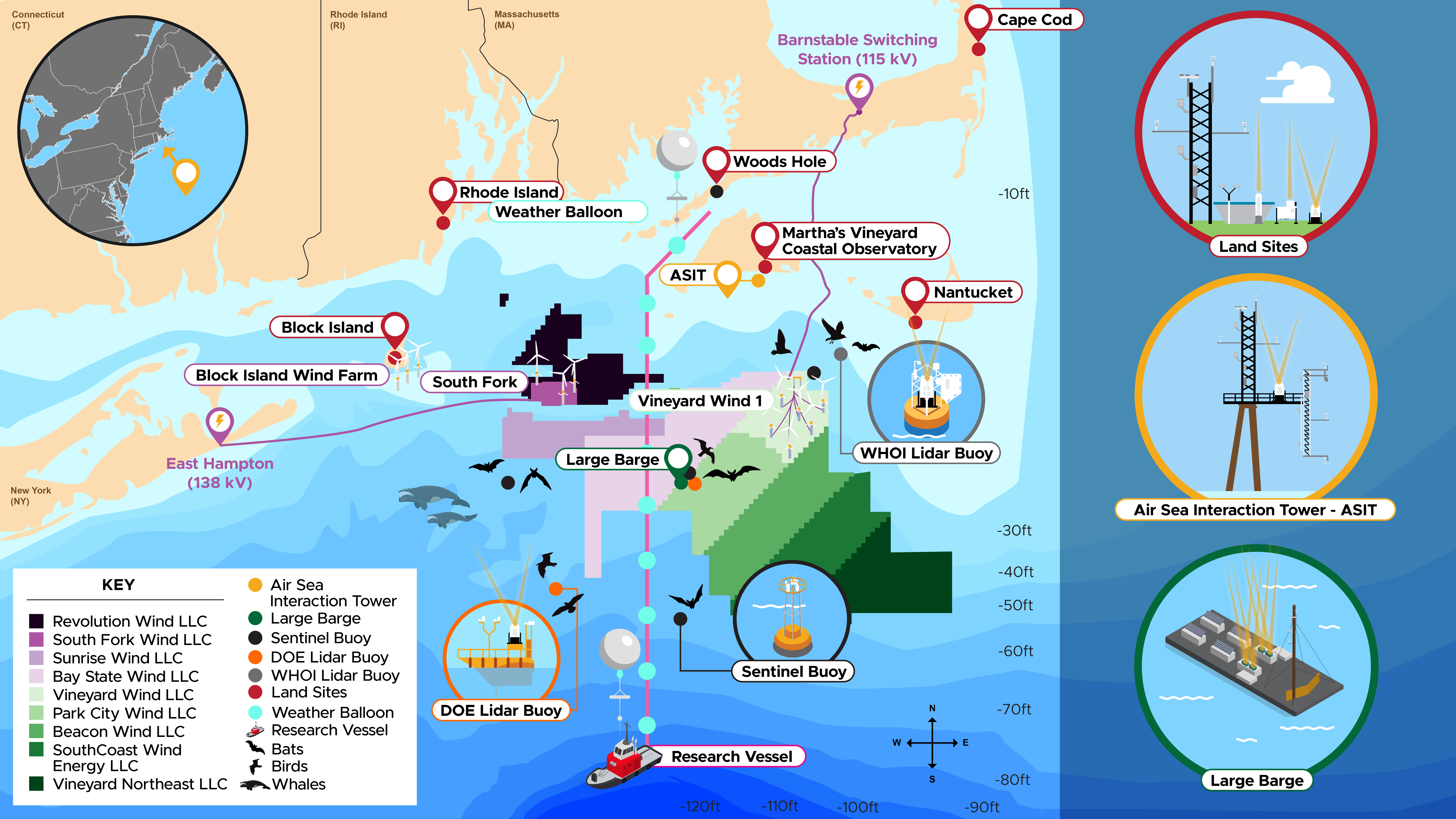
The WFIP-3 team will place instruments at locations in and near existing wind energy lease areas along the U.S. northeast continental shelf. This placement will allow them to study the marine atmospheric boundary layer structure as well as the wide area atmospheric and ocean dynamics via a multi-scale array.
Offshore Air-Sea Interaction Tower
The project will leverage Wood Hole’s Air-Sea Interaction Tower, which is a unique facility and the only tower along the United States continental shelf that was specifically designed and built for the coupled boundary layer research. The tower is 22-m tall, located 3 km south of Martha’s Vineyard in 15 m of water. In addition to instruments on the tower, the tower will host a scanning Doppler lidar, laser disdrometers and a thermodynamic profiler.
Offshore Barge
Deployed offshore to provide observations of the marine atmospheric boundary layer for targeted periods during the field year, a barge will be used to support both detailed flux observations as well as the deployment of large scanning and remote sensing systems to profile the atmosphere above the sea surface in the middle of the deployed array. The barge will be chartered and deployed on-site by Woods Hole. The barge will be a 130-foot-long, 40-foot-wide, 9-foot-thick draft deck (or spud) barge.
Lidar Buoys
Two DOE lidar buoys and one Woods Hole-built lidar buoy will be deployed in the lease area by Pacific Northwest National Laboratory.
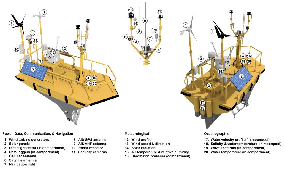
Sentinel Surface Buoys
Seven surface buoys, two with co-located subsurface buoys, will measure surface meteorology, turbulent fluxes, wave spectra, and in-water observations of currents, temperature, and salinity to quantify air-sea exchange across the horizontal array. These systems will be distributed around the study region to resolve multi-scale variations in winds, surface meteorology, momentum and heat fluxes, and ocean waves.
Land-Based Field Stations
Six shore-based field sites, stretching from Nantucket to Rhode Island, will provide observations of the marine atmospheric boundary layer using vertically-profiling and scanning lidars, thermodynamic profilers, surface radiometers (longwave and shortwave radiation), precipitation sensors, Ceilometers, 10-m surface met stations, and sonde launches.
Satellite Data
Prior or during the WFIP-3 field campaign, several developing satellite data applications will be researched that help increase the knowledge of offshore wind conditions in the region.
All the data will be made publicly available and archived on the Wind Data Hub.