Wind Forecast Improvement Project-3
Wind Forecast Improvement Project-3
Offshore wind energy development in the United States is accelerating, with projects currently representing 40 gigawatts of proposed installed capacity. However, there are still substantial, unsolved challenges with forecasting winds and turbulence over the ocean.
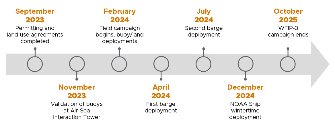
To help overcome the challenges and help bring offshore wind energy to fruition, the Wind Forecast Improvement Project-3, or WFIP-3, is an 18-month offshore wind campaign that will begin in February 2024.
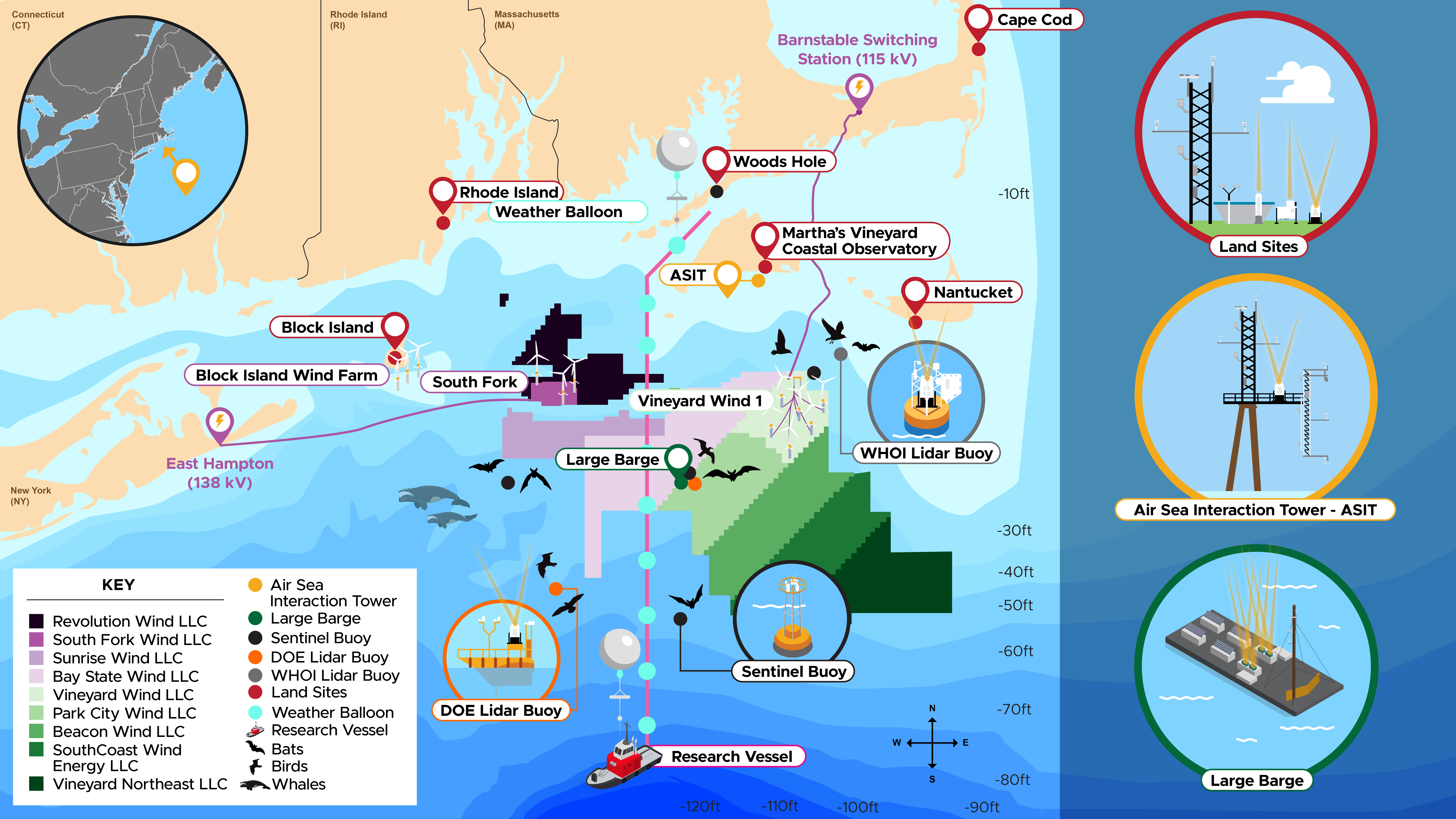
The study will take place in the northern third of the Mid-Atlantic Bight, the home to nine active wind energy lease areas. The Northeastern U.S. shelf is a relatively wide shelf bordered by the Gulf Stream offshore and New England to the north.
WFIP-3 is a Department of Energy’s Wind Energy Technologies Office funded project in collaboration with several research institutions. The federal component is led by Pacific Northwest National Laboratory as well as the National Oceanographic and Atmospheric Administration and the non-federal component is led by Woods Hole Oceanographic Institute.
The study
The study seeks to improve understanding of the physical phenomena in the atmosphere and ocean that dictate the structure and variability of the wind resource in the marine atmosphere boundary layer—the part of the atmosphere that has direct contact with the ocean.
Here, the vertical profile and variability of wind speed, wind direction, and turbulence intensity within turbine rotor planes are critical for wind energy. Sea breezes, low-level jet streams, and coastal storms in the atmosphere, as well as tidal fronts, eddies, and cold water upwelling in the ocean, can significantly impact the distribution of wind at turbine hub heights.
The goals of WFIP-3 are three-fold:
- Improve the physical understanding of mesoscale meteorological and oceanographic processes that directly affect wind resource characterization in the offshore environment of the nation’s East Coast.
- Deploy and operate a 3-D multiscale sensor array to characterize the vertical and horizontal structure of the marine atmosphere boundary layer to provide the observations needed to improve and assess numerical weather forecasting models.
- Incorporate and validate the new understanding into foundational numerical weather forecasting models and other atmospheric and oceanographic models to improve wind energy forecasts.
The project is informed by input from the “Workshop on Research Needs for Offshore Wind Resource Characterization,” which was held in Alexandria, Virginia, in March 2019.
WFIP-3 follows the land-based WFIP-1, which was conducted from 2011 to 2013 and covered the upper Great Plains and west Texas, and WFIP-2, which was conducted from 2015 to 2019 in the rugged Columbia Basin in the Pacific Northwest.
Timeline