September 16, 2021
Research Highlight

Detecting the Unseen Forces Controlling Thunderstorm Formation

Researchers measured the complex air flow that governs the formation of clouds and thunderstorms

A doppler on wheels mobile weather radar setup on the right side of a photograph with a bright blue sky and green, grassy field

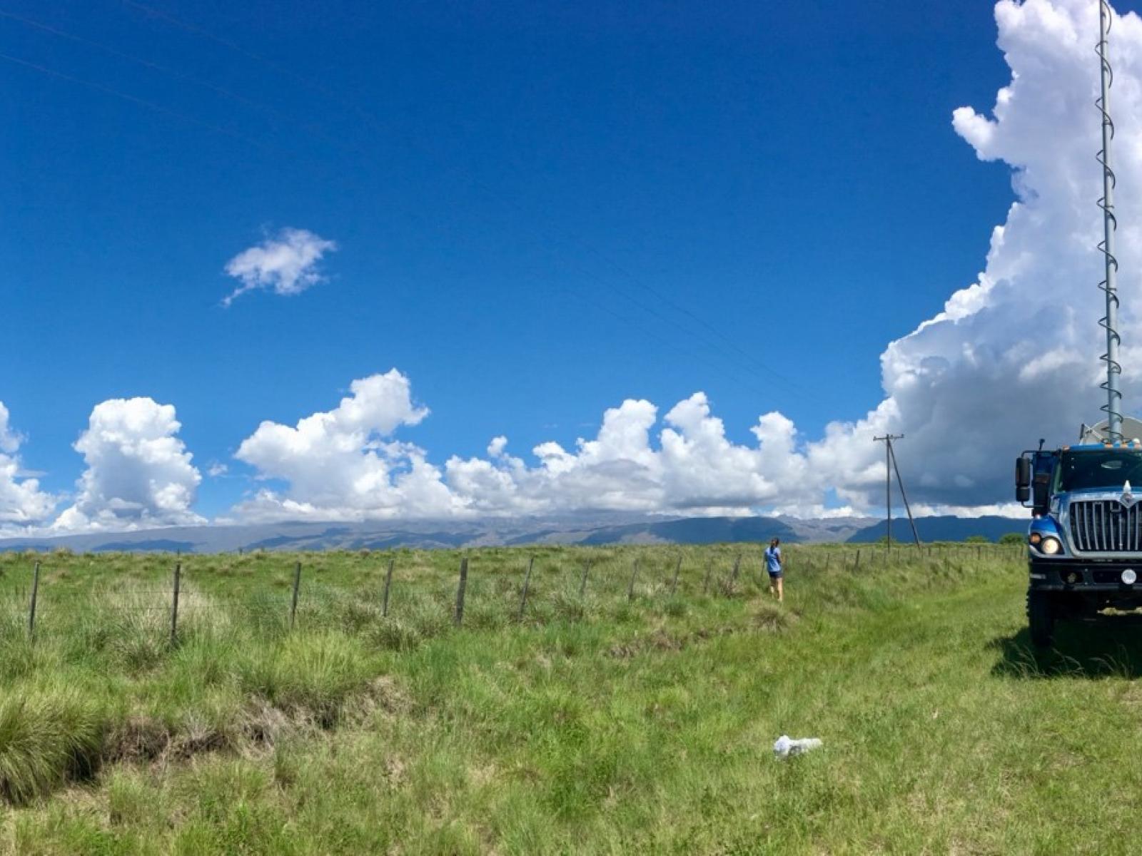
A Doppler on Wheels mobile weather radar collects data researchers use to understand the structure of clouds that grow into deep thunderstorms storms over Argentina’s Sierras de Córdoba range.

(Image by Manikandan Rajagopal | The University of Utah)

The Science

The mountains of central Argentina generate some of the most intense thunderstorms in the world. Using weather radars, researchers mapped the complex wind patterns responsible for the development of the clouds that grow into these intense thunderstorms. These data provide a very rare look at the size of clouds as they deepen and begin to rain. The researchers relate the structure of the clouds to the surrounding environment by combining the radar-measured wind data with temperature and humidity data collected by weather balloons. Comparing this data to cases occurring in the U.S. allows researchers to improve their understanding of when, where, and how thunderstorms form all over the world.

The Impact

Recent scientific research theorizes that both the width of a cloud and the humidity of the air surrounding it control whether it will grow into a thunderstorm. Before this study, there were very few sources of observational data to adequately evaluate this idea. The results confirm that the width of a cloud is one factor that determines if it will become a thunderstorm and that the size of these growing clouds might be controlled by larger updrafts of the surrounding wind. Environments with deep layers of high relative humidity in the upper atmosphere, resulting from large surrounding updrafts, favor thunderstorms. This information will help improve forecasts of clouds and thunderstorms.

Summary

Thunderstorms are difficult to predict due to inadequate routine measurements of the atmospheric conditions near their formation sites. Researchers probed characteristics of the atmosphere that support or suppress the development of deep thunderstorms using a rare set of coordinated weather radar and balloon measurements collected near growing cumulus clouds. They found that many metrics of the environment traditionally used by operational meteorologists to predict thunderstorms (for example, an unstable temperature profile) did not always reflect the probability that sustained storms would form. Instead, thunderstorm formation more directly corresponded to the presence of several kilometer-sized updrafts organized by the surrounding wind. These updrafts appear to assert an influence upon the size of growing clouds, indicating that they play a direct role in the successful generation of thunderstorms. Sustained precipitating storms tended to be approximately 3 – 5 kilometers wide at their earliest detectable stages. Short-lived and weak storms were comparatively narrow, typically around 2 – 3 kilometers wide. Measurements of these relative cloud and updraft sizes are quite valuable for verifying hypotheses about the forces governing storm formation and will help to refine the weather and climate models used to forecast clouds and thunderstorms.

PNNL Contact

Jerome Fast, Pacific Northwest National Laboratory, Jerome.Fast@pnnl.gov

Funding

Funding for this work was provided by:

  1. By the U.S. Department of Energy’s Office of Science, Biological and Environmental Research program as part of the Atmospheric System Research program. Work was funded by the Integrated Cloud, Land-Surface, and Aerosol System Study (ICLASS) SFA.  
  2. By National Science Foundation grants AGS-1661707, AGS-1541624, and AGS-1661662, administered through the University of Colorado, Boulder; University of Utah; and associated subcontracts between these institutions to Pacific Northwest National Laboratory.

Published: September 16, 2021

J.N. Marquis, et al. "Low-level Mesoscale and Cloud-scale Interactions Promoting Deep Convection Initiation.” Monthly Weather Review, 149, 2473-2495, (2021). [DOI: 10.1175/MWR-D-20-0391.1]