May 9, 2017
Feature

Topographic Challenges in Land-Surface Modeling

Scientists developed a new method to describe the impacts of topographic variability in Earth system modeling

ColumbiaRiverBasin-TesfaLeung-May2017-550

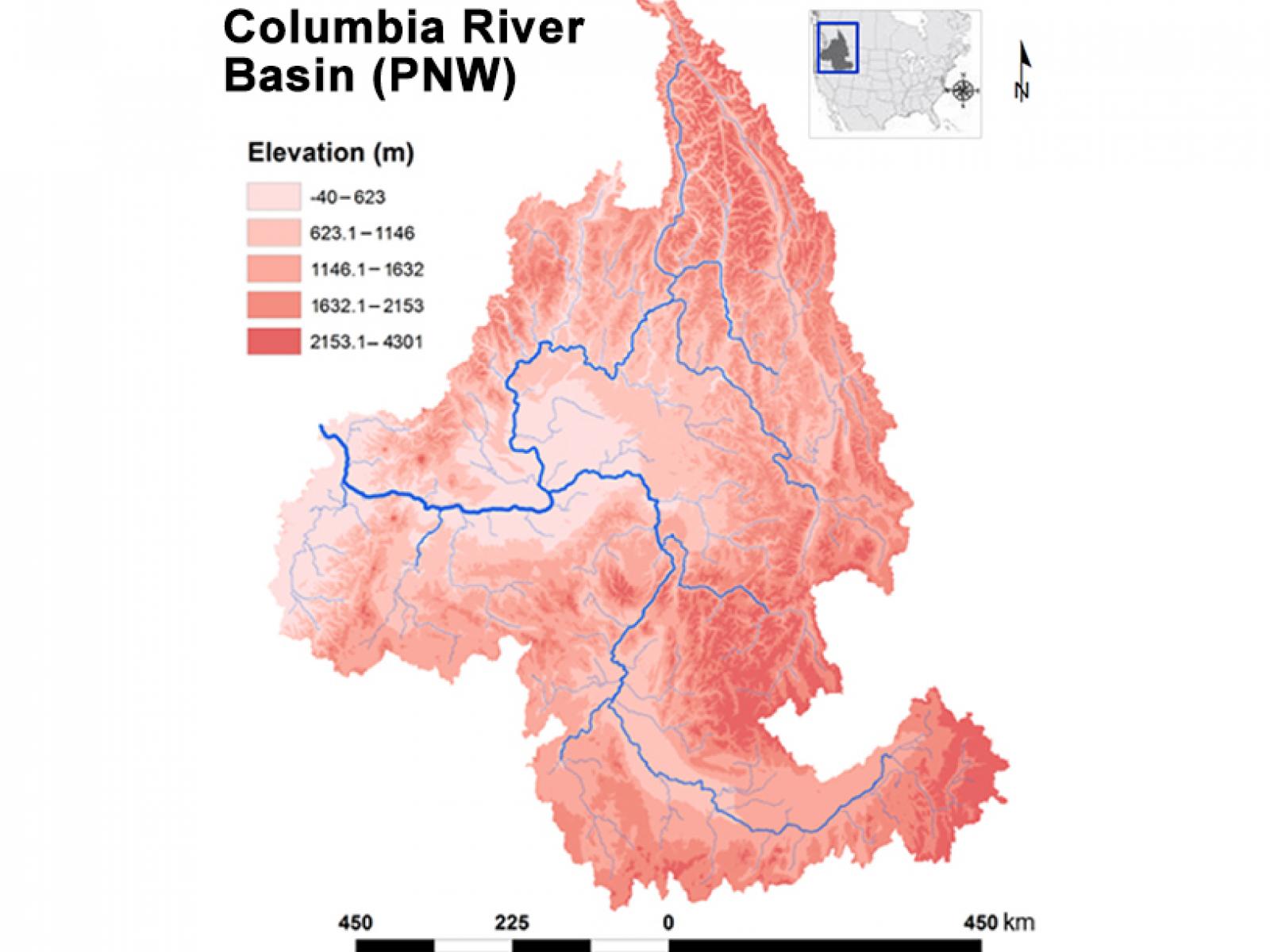
The Shape of Things The topographic distribution of the Columbia River basin formed the basis of the study to understand how best to represent topographic variability within watersheds, improving understanding of water cycle processes and the associated land-atmosphere interactions in regions with complex terrain. 

Graphic courtesy of the researchers.

If the Earth was flat and contained only water, it wouldn't be much of a challenge to simulate its workings. But mountains, rivers, oceans, and valleys create challenges. Researchers at Pacific Northwest National Laboratory devised two techniques to represent the topographic variability within watersheds, and compared them in regions with complex terrain.

The researchers demonstrated that adopting systematic descriptions of landforms (a.k.a. geomorphologic concepts) when dividing watersheds into multiple spatial units increases the topographic variability captured within watersheds. When implemented in models, their method can improve modeling of climatic and land-cover variability with only a small bump in the model's computational requirements.

Why It Matters: Land and Earth system models divide regions into units and apply computational formulas to approximate cloud formation, precipitation, air movement, heat exchange and the like. But all those processes are also influenced by each region's land surface and terrain. Mountains trigger different effects from valleys and plains. Lands near bodies of water have different climate influences from those near deserts. Thus, topography—the description of the local terrain—has a large effect on land surface processes by its influence on what happens in the atmosphere overhead, how the soil and vegetation may vary, and how river networks and drainage affect the area.

Scientists in this study employed a modeling structure that captures the variability of regional (or subgrid) topography enabling land-surface models to produce more accurate simulations of the water cycle over and through the land and the associated land-atmosphere interactions.

Methods: PNNL researchers explored new land surface representations by dividing watersheds into subgrid units. This allowed them to take advantage of newly developed patterns and scaling properties of atmospheric, hydrologic, and vegetation processes in land-surface models. They developed geolocated and non-geolocated subgrid units by applying two watershed delineation methods (local and global), defining area-of-interest boundaries over the Columbia River basin in the northwestern United States.

The "global method" combined a global surface elevation classification method to define topographic slope and landscape orientation. The "local method" used a concept called hypsometric analysis that studies the relationship between elevation and the area of a watershed. This analysis was combined with the classification of landscape orientation. Because the hypsometric analysis implicitly relates elevation and slope, the local method only needed to represent subgrid variability of elevation and landscape orientation (two topographic aspects) rather than the three topographic aspects needed in the global method (elevation, slope, and landscape orientation).

The comparison showed that land-surface modeling using the local method turns out to be more computationally efficient. The local method improved the skill of the subgrid classification in capturing topographic variability through the adoption of the hypsometric curve for delineating watersheds into multiple subgrid units.

What's Next: Future efforts will implement the non-geolocated subgrid units from the local method in the ACME Land Model to investigate how the addition of topographic subgrid units may translate to improved simulations of evapotranspiration, soil moisture, snowpack, and runoff and streamflow. Researchers will investigate how coupling land-surface models with the non-geolocated subgrid units to an atmosphere model with a subgrid representation of mountainous precipitation may further improve modeling of land-atmosphere interactions in topographically diverse regions.

Acknowledgements

Sponsor: This research was supported by the U.S. Department of Energy Office of Science, Biological and Environmental Research as part of the Earth System Modeling program for the Accelerated Climate Modeling for Energy (ACME) project.

Reference: Tesfa TK and LR Leung. 2017. "Exploring New Topography-Based Subgrid Spatial Structures for Improving Land Surface Modeling." Geoscientific Model Development 10: 873-888. DOI: 10.5194/gmd-10-873-2017

Download Publication

Key Capabilities

###

About PNNL

Pacific Northwest National Laboratory draws on its distinguishing strengths in chemistry, Earth sciences, biology and data science to advance scientific knowledge and address challenges in sustainable energy and national security. Founded in 1965, PNNL is operated by Battelle for the Department of Energy’s Office of Science, which is the single largest supporter of basic research in the physical sciences in the United States. DOE’s Office of Science is working to address some of the most pressing challenges of our time. For more information, visit https://www.energy.gov/science/. For more information on PNNL, visit PNNL's News Center. Follow us on Twitter, Facebook, LinkedIn and Instagram.
Published: May 9, 2017

PNNL Research Team

Teklu Tesfa and L. Ruby Leung