ThermalTracker-3D
ThermalTracker-3D
Gleaning bird and bat flight data in 3D
Gleaning bird and bat flight data in 3D
According to the U.S. Department of Energy, more than 2,000 gigawatts of electricity could be generated from the abundant, strong, and consistent winds blowing off U.S. coastlines each year—nearly double the nation’s current electricity use. Even a small fraction of that renewable energy source could provide inexpensive, clean power to nearly 6.5-million homes.

However, while it represents significant energy potential, offshore wind also comes with some uncertainty—specifically, how wind technologies such aslarge turbines would affect bird and bat populations in remote locations. In these difficult-to-access locations are the habitats and flight pathways of several avian species.
Before offshore wind developers can begin developing and siting wind farms, they must first have solid data to support environmental permitting to protect these birds and bats—especially those covered under the Endangered Species Act and Migratory Bird Treaty Act—from collision with powerful wind turbine blades and displacement from habitats.
But much of this data—such as passage rates, flight height, and flight speed—are not available to support the risk assessments needed for environmental permitting, especially for U.S. offshore wind locations.
The result is that the environmental permitting may impose excessive monitoring and mitigation requirements that are challenging or costly using existing detection and tracking technologies, particularly at these remote offshore locations.
ThermalTracker-3D: Data to help birds and bats coexist with turbines

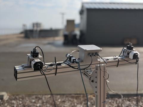
Photo: Shari Matzner | PNNL
ThermalTracker-3D is a solution developed by engineers at the Pacific Northwest National Laboratory (PNNL). The system, patented in December 2020, is a thermal stereo vision technology that can quantify the flight activity of birds and bats at remote locations targeted for offshore wind farm development.
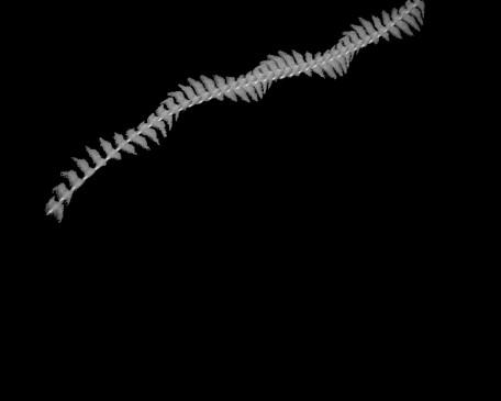
The technology is made up of custom software that automatically captures 3D flight tracks of birds and bats from a stereo pair of thermal cameras, in real-time. The flight track data is saved in a concise format that is transmitted from remote locations to shore—eliminating the need for complex visits to the remote site to retrieve the data.
ThermalTracker-3D is the only known system of its type equipped with 3D tracking capability, providing the most comprehensive information needed to determine if birds and bats are flying at heights where they are at risk of collision with turbine blades and whether they are avoiding existing turbines. The 3D capability captures detailed information about wingspan, body length, flight speed and height—critical data needed to avoid excessive monitoring and mitigation requirements imposed by environmental risk assessments.

Shari Matzner | PNNL
The ThermalTracker-3D software operates in real time and only saves images that show flight tracks— reducing the amount of saved data to less than 1/300 of the raw video data. This allows the system to run in remote locations for several weeks without running out of storage or bandwidth.
The stereo vision also helps reveal the size of animals to infer their species. The thermal cameras allow the system to operate not only in daytime but also at night to glean information on nocturnal species—which differs from existing systems that rely on light and are limited to daytime operations. It is also the only system that has the best accuracy in all weather conditions, including those where visibility is limited—especially important for rugged, blustery, and often stormy weather encountered off the nation’s coastlines. And it detects birds and bats small to large in size, where similar systems only capture medium- to large-sized birds and bats.
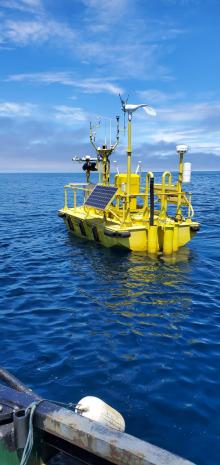
ThermalTracker-3D is easily integrated with offshore platforms such as buoys, substations, or turbines. The technology was deployed in 2021 on a lidar research buoy stationed off the coast of California that collected oceanographic and meteorological data in support of the Bureau of Ocean Energy Management (BOEM). BOEM gathered data over a one-year period to support decisions on wind lease sites that will bring a new form of renewable energy to that state. ThermalTracker-3D collected seabird data needed to characterize BOEM’s planned wind energy locations—seabird flight activity correlated with wind speed and direction.
The U.S. Department of Energy’s Wind Energy Technologies Office supported development of ThermalTracker-3D.