July 7, 2025
Research Highlight

Exploring Soil Respiration Spatial Patterns in Coastal Ecosystems using Remote Sensing and Machine Learning

Coastal terrestrial-aquatic interfaces are crucial contributors to global biogeochemical cycles but gas flux in these transition zones remains poorly understood due to their highly dynamic nature

satellite image showing chesapeake bay

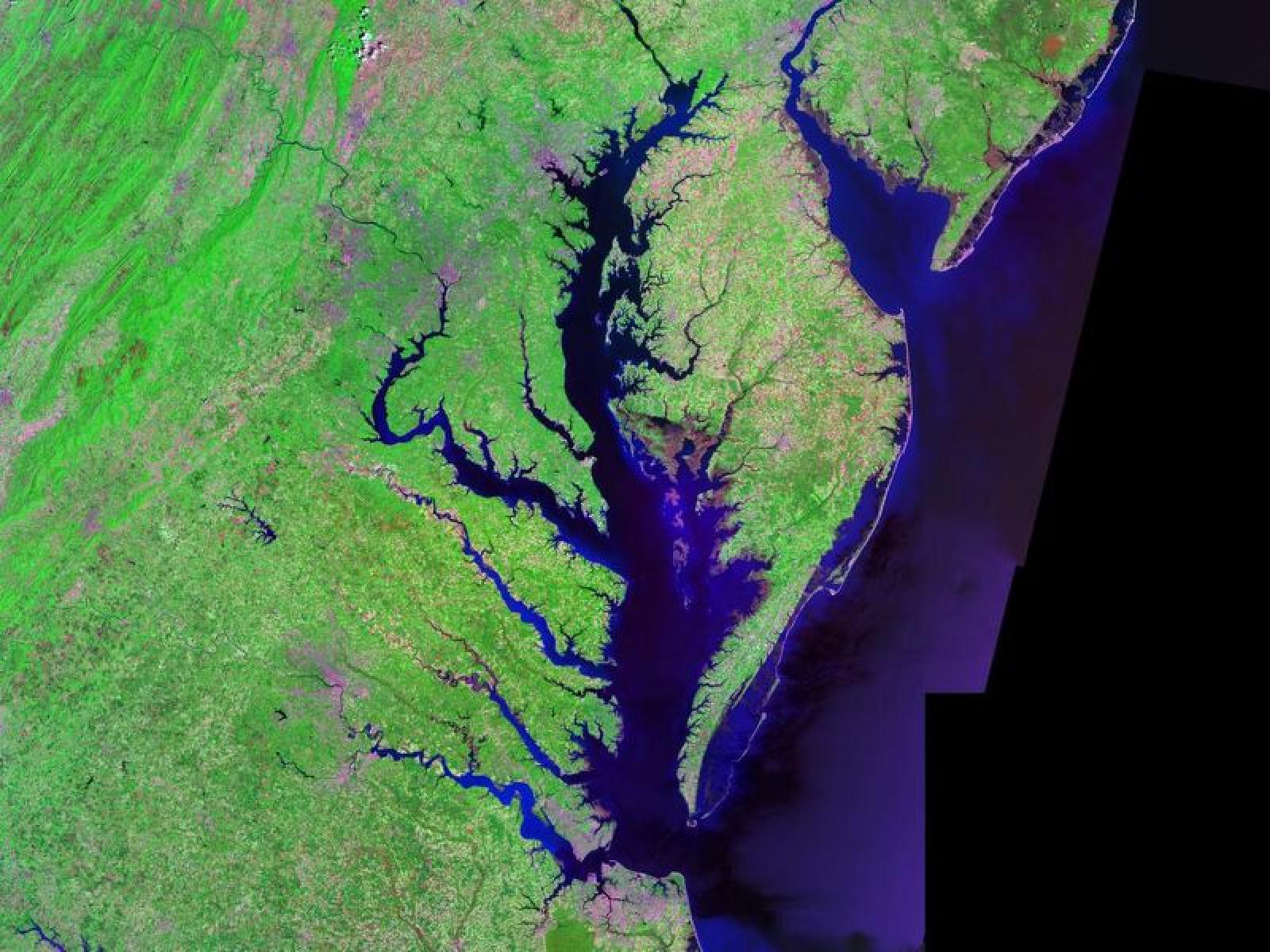
Eco-zones across Chesapeake Bay were identified using open-source remote sensing and geographic information systems (GIS) data.

(Image: NASA [Wikimedia Commons])

The Science

The release of gases from soil is known as soil respiration and understanding how environmental factors influence this process in coastal terrestrial-aquatic interfaces (TAI) remains a significant challenge. Gas efflux in TAI's remains poorly understood due to the complex interplay of tides, topography, environmental variability, and land use changes. This study characterized above- and below-ground properties to explore the spatial heterogeneity of the TAI ecosystem within the Chesapeake Bay area and to evaluate the major drivers of soil respiration. Results demonstrated that soil respiration was mostly affected by the highest and lowest temperatures across the region. However, different sub-ecosystems had other key factors that played a role too; precipitation influences vegetated lands, while soil pH is crucial in forested areas. In wetlands, soil respiration was primarily influenced by tidal fluctuations and soil sand content. In cropland soils, clay content, sand content, and bulk density significantly influence soil respiration.

The Impact

Coastal research has traditionally relied on the field measurements of fluxes into and out of the TAI ecosystem, with a focus on coastal upland and wetland ecosystems and the boundary between them. This study broadened the scope of research to include a wider range of eco-zones by utilizing open-source remote sensing and geographic information systems (GIS) data. This approach facilitates the delineation of spatial heterogeneity and identifies driving factors of a crucial process, enhancing scientists' understanding of nutrient dynamics in coastal ecosystems. This innovative approach improves predictions of gas emissions from coastal soils and can be applied globally.

Summary

Researchers investigated the spatial variability of soil respiration in the Chesapeake Bay's coastal TAI using multi-source remote sensing and spatial datasets. By employing hierarchical clustering and machine learning techniques, eight distinct environmental clusters within the region were identified. Each cluster was characterized by unique combinations of vegetation phenology, environmental variables, land cover, biodiversity, topography, soil properties, and tidal influences. Maximum and minimum temperatures are the primary drivers of soil respiration across all clusters, with precipitation significantly affecting vegetated lands. Additionally, soil pH is crucial in forested areas, while bulk density is a major factor in croplands with high clay content. In wetlands, elevation and sand content play significant roles, with clay content being more relevant in non-inundated wetlands. This study demonstrates the effectiveness of integrating open-source remote sensing and GIS data to understand the spatial heterogeneity and mechanisms driving soil respiration in coastal ecosystems. The approach of this study is essential for improving gas flux models to support sustainable management of coastal ecosystems. The variability in primary drivers across different sub-ecosystems underscores the need for tailored strategies in modeling and managing emissions in these dynamic environments.

Contacts

Nicola Falco, corresponding author, Lawrence Berkeley National Laboratory, NicolaFalco@lbl.gov

Yinan He, lead author, Lawrence Berkeley National Laboratory, yinan.he@lbl.gov

Vanessa L. Bailey, COMPASS-FME principal investigator, Pacific Northwest National Laboratory, vanessa.bailey@pnnl.gov

Funding

This research is based on work supported by COMPASS-FME, a multi-institutional project supported by the Department of Energy, Office of Science, Biological and Environmental Research as part of the Environmental System Science program. This project is led by Pacific Northwest National Laboratory which is operated for DOE by Battelle Memorial Institute. 

Related Links

ESS-DIVE data package:

He, Y., Falco, N., Bond-Lamberty, B., N. Myers-Pigg, A., E. Newcomer, M., Ladau, J., R. Holmquist, J., and B. Brown, J. 2024. Remote Sensing and GIS data at 1km-grid over Chesapeake Bay used in “He et al. 2024, Effects of spatial variability in vegetation phenology, climate, landcover, biodiversity, topography, and soil property on soil respiration across a coastal ecosystem.” https://doi.org/10.15485/2326012.

Published: July 7, 2025

He, Yinan, Ben Bond-Lamberty, Allison N. Myers-Pigg, Michelle E. Newcomer, Joshua Ladau, James R. Holmquist, James B. Brown, and Nicola Falco. 2024. "Effects of Spatial Variability in Vegetation Phenology, Climate, Landcover, Biodiversity, Topography, and Soil Property on Soil Respiration across a Coastal Ecosystem." Heliyon 10: e30470. https://doi.org/10.1016/j.heliyon.2024.e30470.