The Lesser-Told Story of Water
PNNL leads the charge to forge a common understanding across the periodically flooded areas of our planet
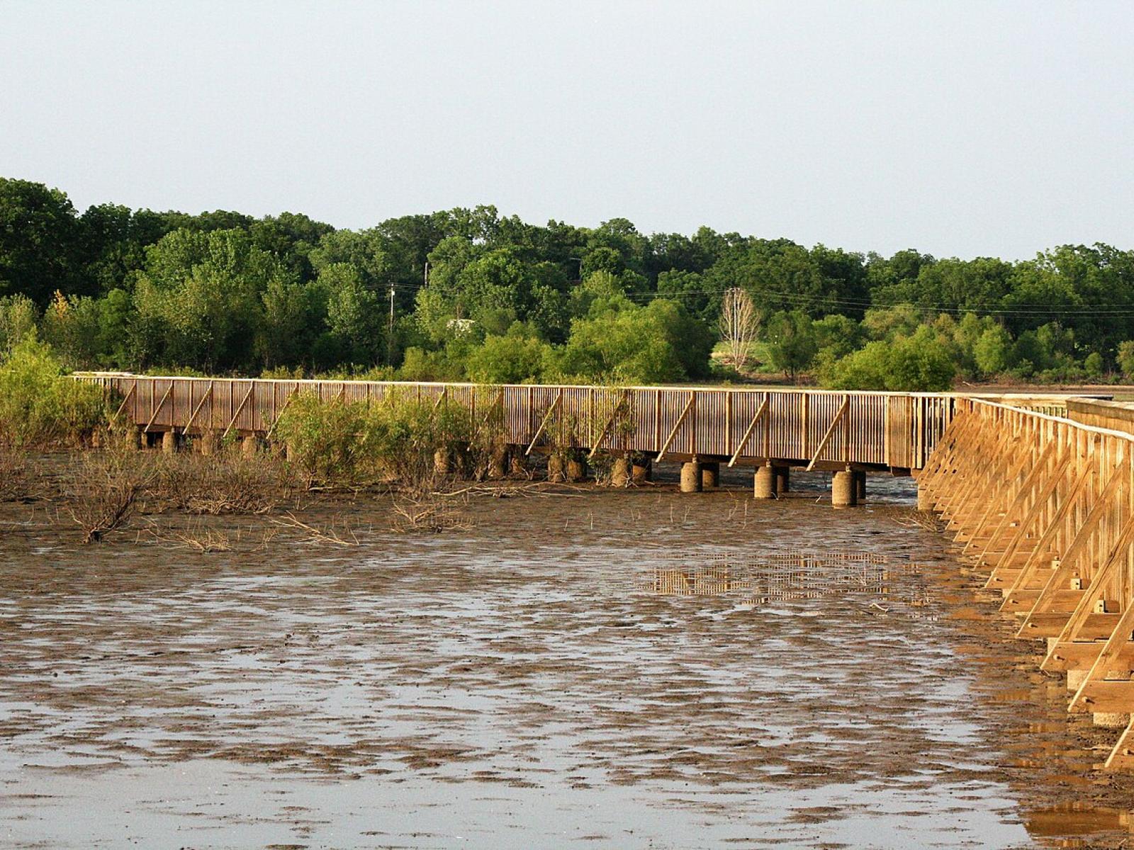
Unlike permanent bodies of water, inundation in variably inundated ecosystems is temporary and can fluctuate. This intermittent water coverage, from events like snowmelt or hurricanes, lasts anywhere from a few minutes to several months, creating a highly dynamic environment.
(Image by Brandonrush | Wikimedia Commons)
When we think of the water on Earth, it’s often easier to focus on the clear boundaries between where it continuously is and where it isn’t: oceans, lakes, and rivers vs. deserts and other dry expanses of land. But what about the spaces in between, where visible water on the land surface isn't always present—but also isn't entirely absent?
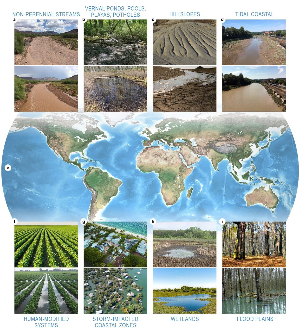
These areas are known as variably inundated ecosystems (VIEs), where land is periodically covered with water. This can include places you might presume, such as wetlands, tidal systems, and floodplains. However, VIEs also exist in areas you might not expect like stormwater infrastructure, agricultural irrigation areas, hillslopes, and more. Together, VIEs make up at least 7 percent of Earth’s total land surface. For context, lakes only occupy about 3 percent.
Pacific Northwest National Laboratory scientist James Stegen and an international team of collaborators published a comprehensive review of VIEs earlier this year. Their work presents a detailed framework for studying these systems, addressing the long-standing challenges posed by the vast spatial and temporal scales of VIEs.
Unlike permanent bodies of water, inundation in VIEs is temporary and can fluctuate. This intermittent water coverage, from events like snowmelt or hurricanes, lasts anywhere from a few minutes to several months, which creates a highly dynamic environment. This results in a variety of complex processes that influence water chemistry, soil and sediment properties, vegetation, microbes, and a broad range of other organisms that call these areas home.
A framework for a fluid world
Transferable theories, knowledge, data, and models across VIEs are essential to understand how these systems function and how humans can most productively interact with them without jeopardizing their continued function.
As Stegen explains, “VIEs are small but mighty ecosystems, punching well above their weight as hot spots of nutrient and contaminant transformations, as well as ecological diversity."
Despite knowing that they’re critical ecosystems, Stegen says, "Our understanding of VIEs remains fragmented. As they continue to change, developing a holistic, in-depth understanding of VIEs is important for making accurate predictions about their future.”
Stegen and an international team proposed relying on a continuum-based approach for VIEs. Instead of treating each VIE as separate or isolated, this framework is rooted in the reality that VIEs do not fit neatly into existing categories and, therefore, is instead focused on VIEs as arrays of features. The team also recognized the importance of establishing research processes that operate within an Integrated Coordinated Open Networked (ICON) framework.
ICON principles emphasize intentionally designing research efforts to result in transferability and mutual benefit. This is particularly important for VIEs because they exist essentially everywhere around the globe (hence the transferability aspect) and are relevant to a broad range of societal challenges (hence the mutual benefit).
Bridging scales and systems
Layered within these frameworks, Stegen and the team also found methods that work together to produce important and powerful VIE datasets. For example, long-term field manipulation sites can offer more controlled conditions for the observations and measurements of different variables in VIEs. There are also remote sensing technologies, like satellite imagery and radar, which provide data on inundation dynamics and other variables that influence inundation, such as topography and vegetation. Another important layer involves iterative cycles of models and experiments, which “cross-pollinate” one another—a method known as ModEx.
“Conducting research that transcends individual systems and locations is no small feat,” Stegen emphasizes. “To accelerate and improve our science, we need to be open to ‘out-of-the-box’ concepts and methods. While they can be more challenging to develop and coordinate, the knowledge we gain is invaluable.”
In the end, the goal is to create transferable science with multiple long-term benefits, rather than producing a study with just one application. This research outlines a road map for a unified approach to studying VIEs, which paves the way for more effective, forward-thinking science based on transferable theory, models, and data.
Published: June 25, 2025
Stegen, J. et al.: Reviews and syntheses: Variable inundation across Earth's terrestrial ecosystems, Biogeosciences, 22, 995–1034, https://doi.org/10.5194/bg-22-995-2025, 2025.