GCAM v5.1: Representing the Linkages between Energy, Water, Land, Climate, and Economic Systems
New version extends existing capabilities to include water and an enhanced representation of land.

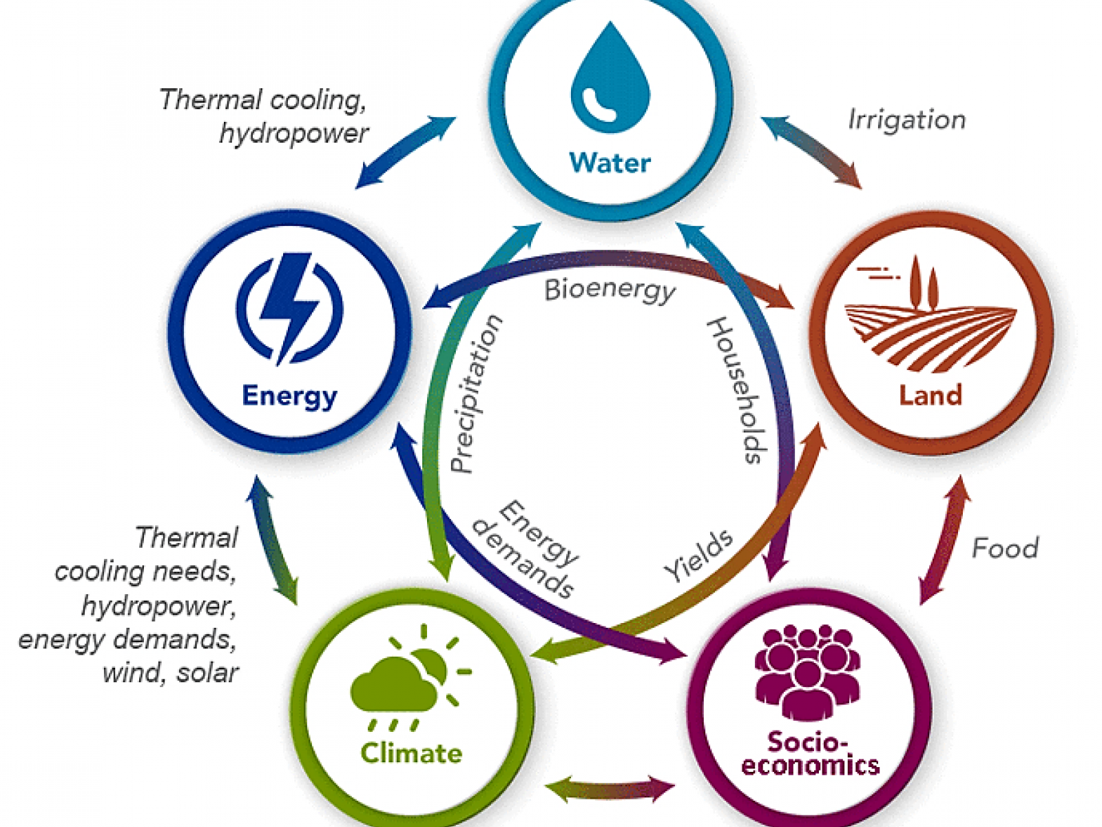
The GCAM model represents human-Earth interactions among five interconnected systems—energy, water, land, socioeconomics, and climate—at local, regional, and global scales.
The Science
Energy, water, land, climate, and economic systems are intricately linked: changes in one system affect the others. Researchers use models to estimate consequences of changes in the human-Earth system, such as changes in electricity demand due to changes in weather. A new version of the Global Change Assessment Model (GCAM), developed by a team at the U.S. Department of Energy’s Pacific Northwest National Laboratory (PNNL), produces enhanced representations of these interactions.
The Impact
Researchers can use GCAM v5.1 to examine a variety of questions regarding how changes in one aspect of the human-Earth system would affect other aspects, such as how different power generation or irrigation technologies might influence energy, water, and land systems.
Summary
How will energy supply and demand change in the future? What are the implications of those changes for water demand and land use? PNNL researchers developed GCAM v5.1, an open-source model that represents the interactions between energy, water, land, climate, and economic systems. GCAM is a market equilibrium model (meaning prices adjust to keep supply and demand equal) that operates from 1990 to 2100 in five-year steps. It can be used to examine, for example, how changes in population, income, or technology cost might alter crop production, energy demand, or water withdrawals, or how changes in one region’s demand for energy affect energy, water, and land in other regions. The research team demonstrated the model’s capabilities with 11 scenarios that considered various future socioeconomic and technology assumptions. The resulting projections demonstrate a wide range of potential future energy, water, and land uses. To evaluate GCAM v5.1, the team compared its results to historical data and to future scenario simulations from earlier versions of GCAM and from other models. The code and inputs for GCAM v5.1 are available on GitHub.
Contact
Mohamad Hejazi, Pacific Northwest National Laboratory, Mohamad.Hejazi@pnnl.gov
Funding
Major long-term support for GCAM development and for the development of this paper comes from the U.S. Department of Energy, Office of Science, as part of research in the MultiSector Dynamics area of the Earth and Environmental System Modeling program.
Revised: June 25, 2019 | Published: May 16, 2020
Calvin K, P Patel, L Clarke, G Asrar, B Bond-Lamberty, RY Cui, A Di Vittorio, K Dorheim, J Edmonds, C Hartin, M Hejazi, R Horowitz, G Iyer, P Kyle, S Kim, R Link, H McJeon, SJ Smith, A Snyder, S Waldhoff, and M Wise. 2019. “GCAM v5.1: Representing the linkages between energy, water, land, climate, and economic systems.” Geoscientific Model Development 12:677–698. DOI: 10.5194/gmd-12-677-2019