
Atmospher Sci & Global Chg
Research Highlights
December 2012
The Middle Child of Tropical Clouds
Mid-level tropical clouds form differently during active and break monsoon periods

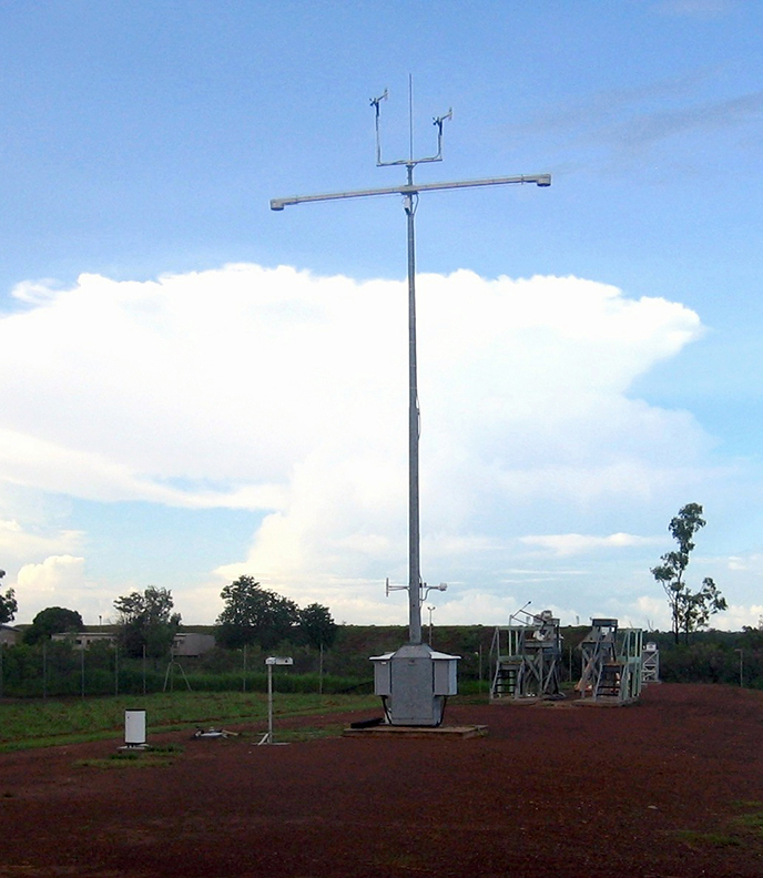
Hovering between the large anvils from storm-forming cumulonimbus clouds at the top, and low boundary layer clouds, mid-level clouds are more difficult to characterize. Finding the origin and characteristics of these clouds in the middle will help provide a better picture of the tropical circulation. Shown in the foreground are meteorological instruments and radiometers. Photo taken at the Tropical Western Pacific site of the ARM Climate Research Facility, located in Darwin, Australia. Enlarge Image. Photo courtesy of ARM.
Results: Scientists at Pacific Northwest National Laboratory employed a method to understand how and when mid-level clouds, hovering between their conspicuous "siblings," form in the tropics. Low and high clouds get most of the attention-because they are easier to detect. The researchers found that the timing and temperature of these thin clouds signal whether they form when the monsoon storms originate over the ocean, or primarily over land. The results show a more complete picture of how clouds influence the global climate.
"In the active monsoon phase, when storms come from the ocean, these mid-layer clouds are more often found after ice precipitation melts and cools the layer, causing more water vapor to condense into a cloud," said Dr. Laura Riihimaki, lead author and atmospheric scientist at PNNL. "In the break monsoon phase, the clouds come primarily from over land. A greater percentage of those mid-level clouds come from direct injection of cloud particles into the layer."
Why It Matters: Thin, mid-level clouds can be quite extensive in the tropics. They reflect a large amount of sunlight back into space and trap heat in the atmosphere. Sandwiched between cloud layers, mid-level clouds have a big effect on temperature and moisture, yet are difficult for scientists to simulate in climate models. Like the overlooked middle child, mid-level clouds are often underestimated. This underestimation makes it difficult to simulate the entire picture of tropical air circulation, including the fuel for tropical storms: heat and moisture. A better view of mid-level clouds and how they influence both is essential to understanding how tropical circulation affects the global climate.
Methods: Satellite and surface views of clouds cannot see mid-level clouds because higher or lower clouds block them. PNNL scientists used a technique called vertically pointing, or "soda-straw" view, to observe cloud formation using lidar and radar together to get a complete picture of how these clouds in the middle occur. This study provides a unique climatology based on four years of observations at the U.S. Department of Energy's Atmospheric Radiation Measurement (ARM) Climate Research Facility's site in Darwin, Australia. The research team combined this technique with data from radiosondes launched on weather balloons, which gather atmospheric measurements, and a scanning precipitation radar, which observes precipitation.
Their results show that thin mid-level clouds more frequently follow stratiform precipitation during the active monsoon rather than the break monsoon period. Cloud layers are more likely to coincide with warmer, more stable layers during the break period. How these clouds form influences the moisture and temperature at mid-levels, which is important to the region's convection profile.
What's Next? The scientists want to characterize how water vapor at the mid-levels of the troposphere changes before and after occurrences of these clouds. Next, they will compare the cloud occurrence results in different monsoon periods with models to improve moisture-cloud process simulation. Also, future work can compare different methods of determining whether clouds are ice or liquid particles to improve cloud calculations in radiative heating rates and fluxes.
Acknowledgments:
Sponsor: The U.S. Department of Energy's Office of Science Biological and Environmental Research Atmospheric System Research program.
User Facility: Data collected at the ARM Climate Research Facility, a U.S. DOE user facility, was used in this study.
Research Team: Laura D. Riihimaki, Sally A. McFarlane, and Jennifer M. Comstock of PNNL.
Research Area: Climate & Earth Systems Science
Reference: Riihimaki LD, SA McFarlane, and JM Comstock. 2012. "Climatology and Formation of Tropical Midlevel Clouds at the Darwin ARM Site." Journal of Climate 25(19):6835-6850. DOI:10.1175/JCLI-D-11-00599.1.